
Explore the Map
Horvat 'Ethri
31.6495° N, 34.9720° E
About
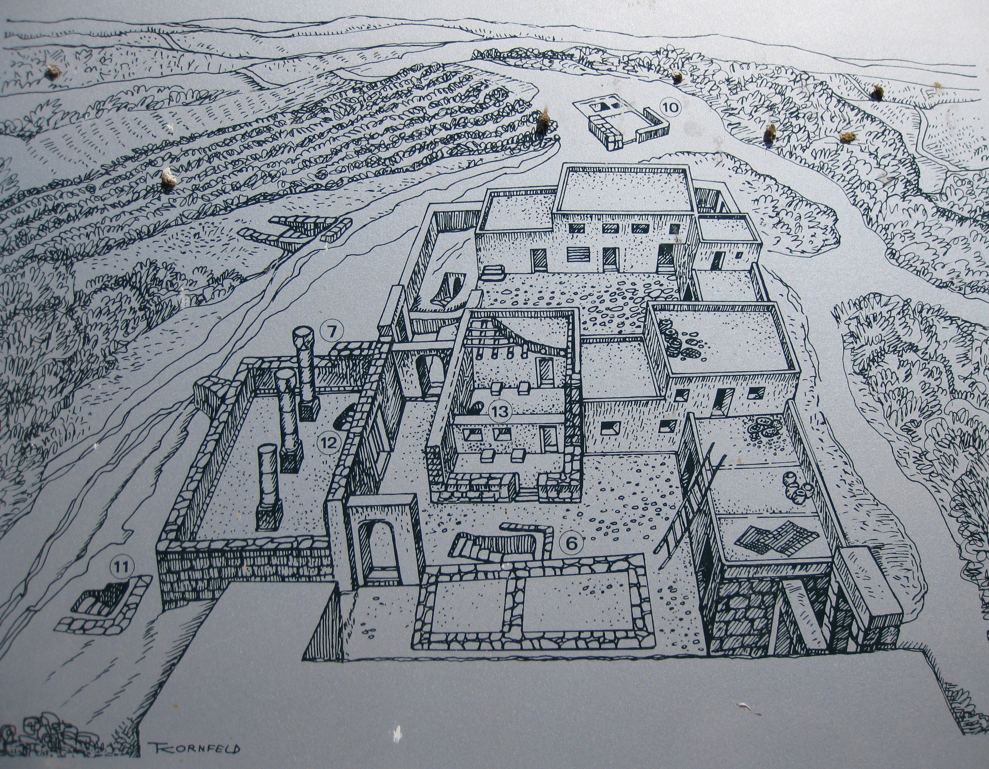
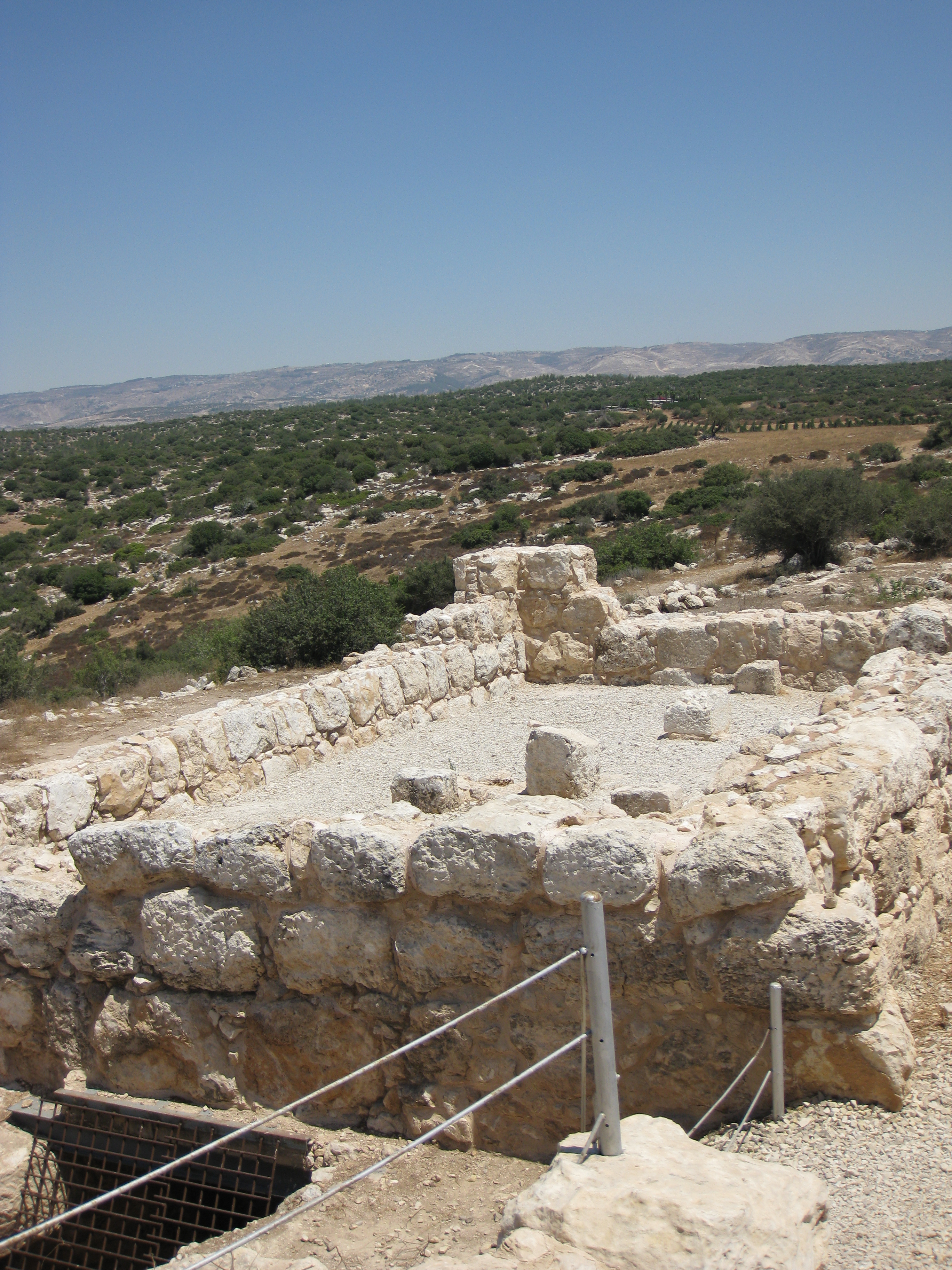
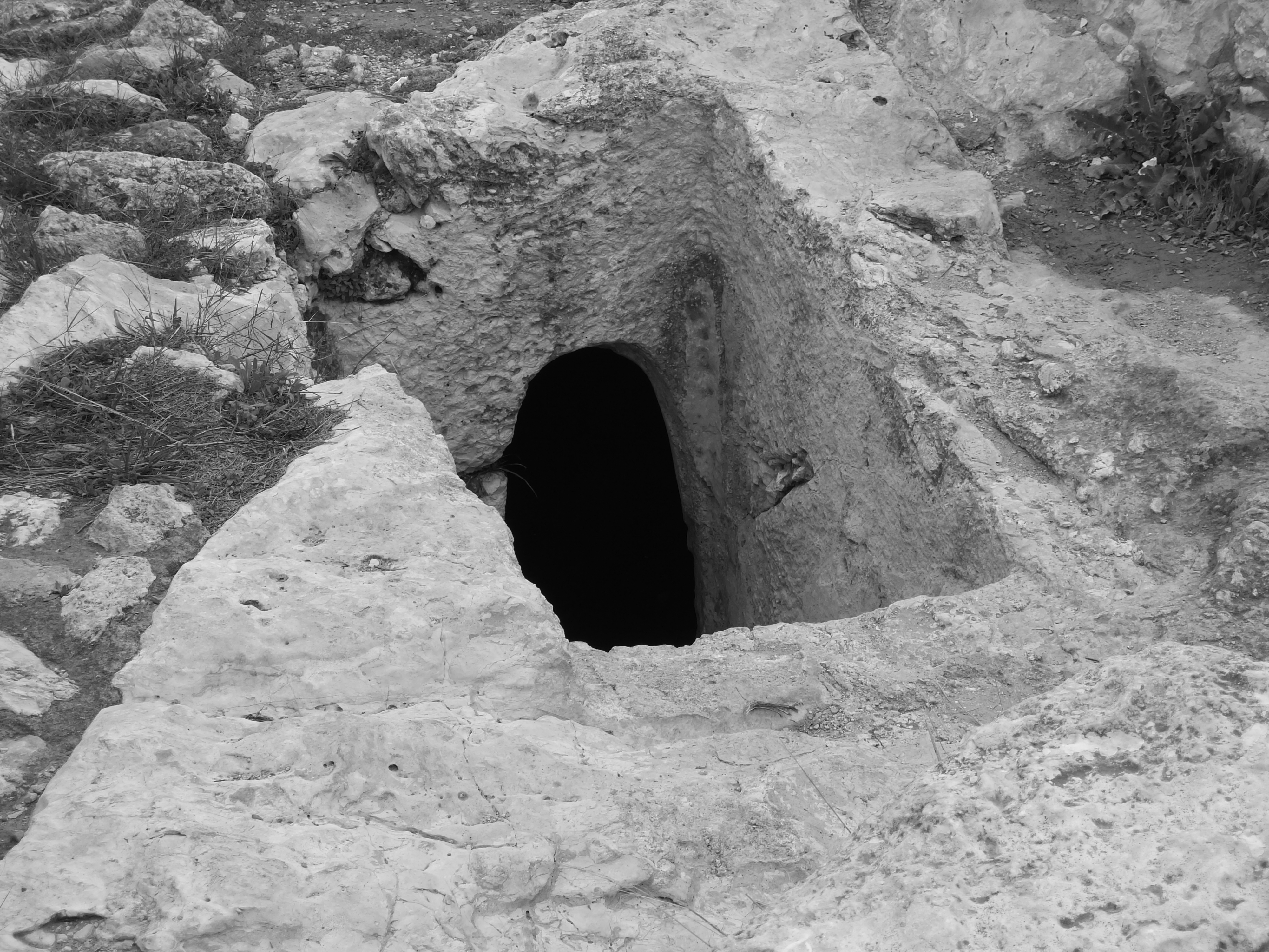
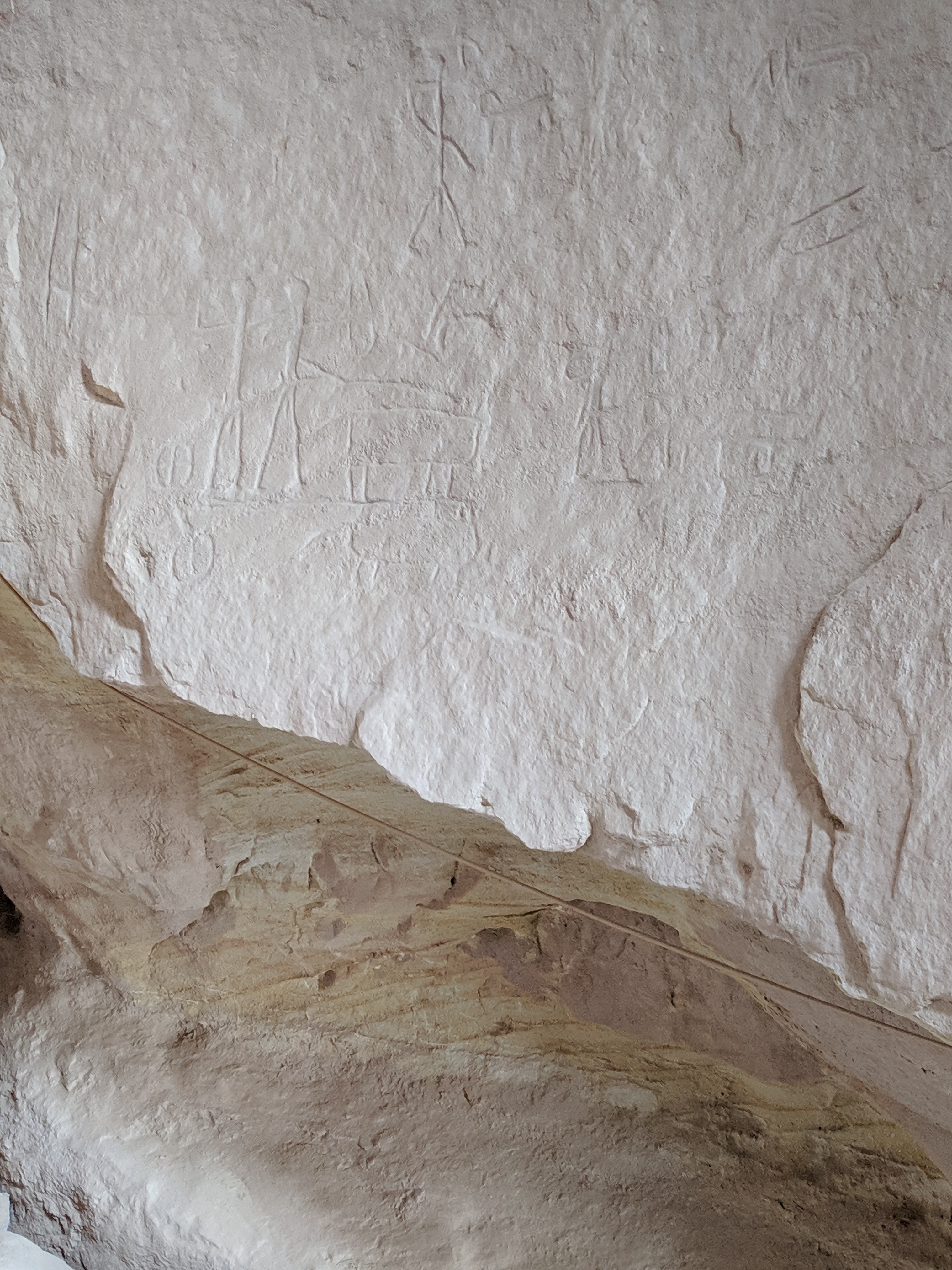
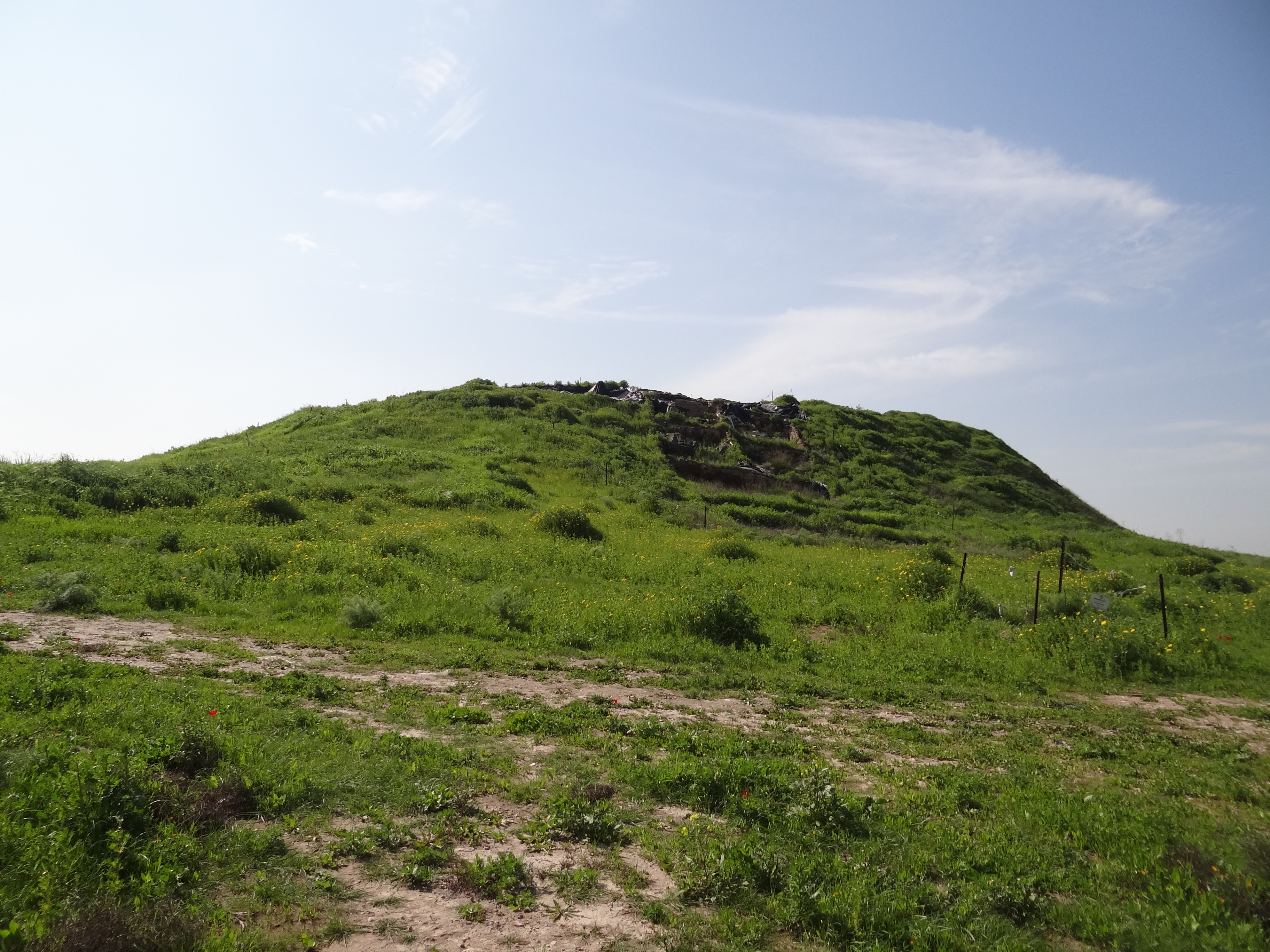
Horvat 'Ethri is an archaeological site located in the Judean Lowlands of modern-day Israel, representing a Jewish village from the Second Temple period. The site is notable for its partially restored ancient synagogue, wine presses, cisterns, mikvehs, stone ossuaries, and an elaborate underground hideout system. It was first occupied during the late Persian period, with significant activity during the Hellenistic and Hasmonean periods, as evidenced by coins of that era. During the early Roman period, the village reached its peak before suffering damage in the First Jewish-Roman War and being violently destroyed during the Bar Kokhba revolt. The late Roman period saw the restoration of the site by a new population, although it was eventually abandoned in the 4th century CE. Horvat 'Ethri offers insights into the Jewish presence and resilience in the region during these tumultuous times.
Gallery
Explore photographs of ancient structures, artifacts, and archaeological excavations
Historical Timeline
Journey through time and discover key events in this site's history
Late Persian occupation
4th century BCE
Hellenistic and Hasmonean period
2nd century BCE
Early Roman village peak
1st century CE
First Jewish-Roman War damage
69 CE
Bar Kokhba revolt destruction
132 CE to 136 CE
Late Roman period restoration
3rd century CE
Site abandonment
4th century CE
Archaeological Features
Unique architectural and cultural elements found at this historical site
Defensive Structures
Miscellaneous Features
Water Management Features
Burial and Funerary Structures
Religious and Ritual Structures
Agricultural and Land Use Features
Domestic and Habitation Structures
Food Production and Processing Features
Frequently Asked Questions
Plan Your Visit
Tours, travel arrangements, and practical information
More Sites in Israel
Tel Kabri
Bronze Age Canaanite palace and settlement
Tel Tanninim
Ancient tell near Mediterranean with Byzantine remains
Tell Qasile
Philistine port city with temples and houses
Timna Valley
Copper mining and unique sandstone formations
Gath-hepher
Ancient town with prophet's tomb nearby.
Tel Zayit
Ancient city with alphabetic inscription evidence.