
Palenque
Palenque is a Classic Maya city-state in Mexico famous for its intricate hieroglyphic inscriptions, the tomb of Pakal the Great, and advanced stone architecture.
Explore the Map
Palenque
17.4842° N, -92.0464° E
About
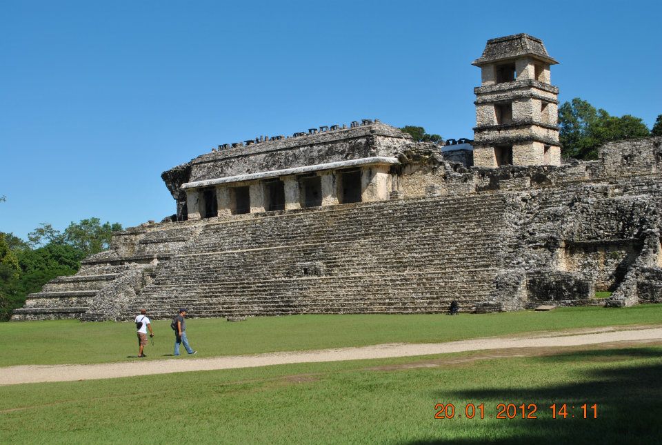
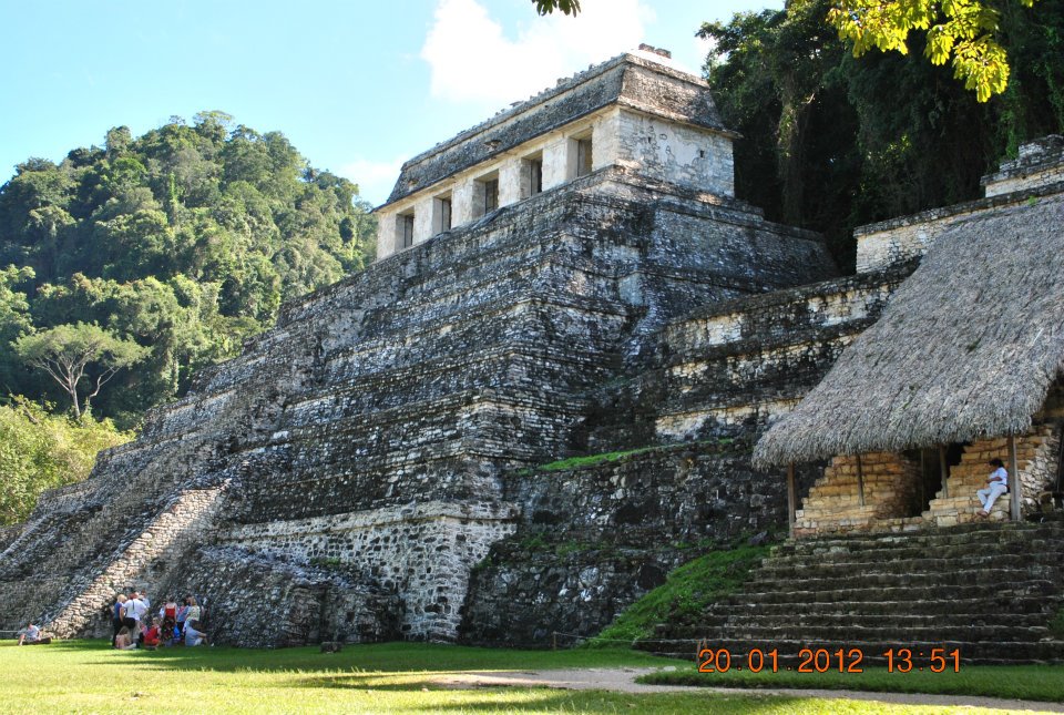
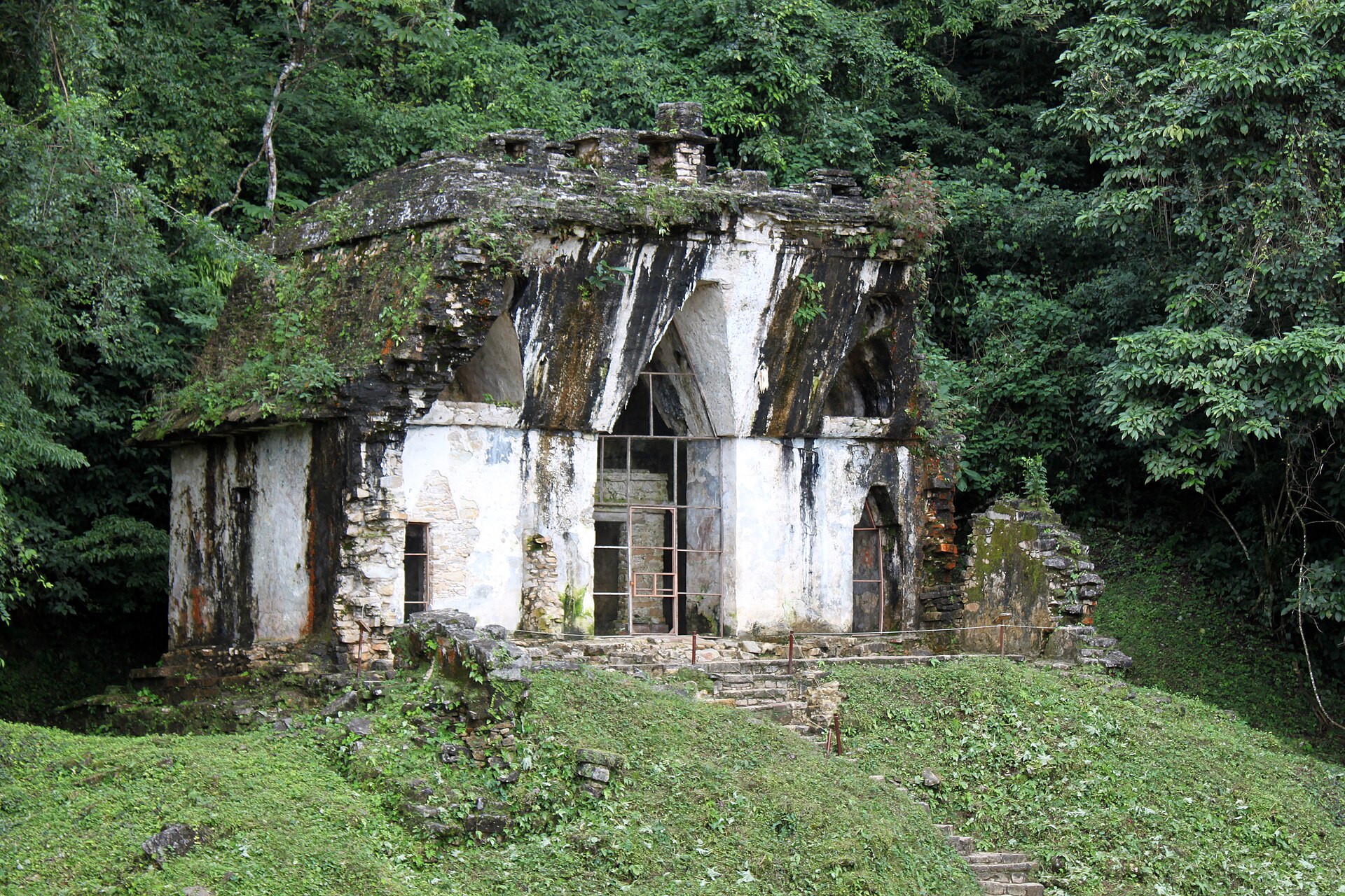
Palenque is a Classic period Maya city-state located in the foothills of the Chiapas highlands in southern Mexico. Situated near the Usumacinta River at approximately 150 meters above sea level, the site was known in antiquity as Lakamha, meaning "big water." The urban center was occupied from roughly 226 BC until its abandonment around 799 AD. During its height, it served as a regional power before being reclaimed by the surrounding tropical jungle of cedar, mahogany, and sapodilla trees. Today, the ruins are recognized as a UNESCO World Heritage site and stand as a primary example of Maya architectural and artistic sophistication. The history of the city, specifically the B'aakal dynasty, is well-documented through extensive hieroglyphic inscriptions that have allowed historians to reconstruct a long sequence of rulers. While its early history involves mythological figures and founders like Kʼukʼ Bahlam I, the city reached its zenith during the 7th century under the reign of Kʼinich Janaabʼ Pakal, also known as Pakal the Great. Following devastating attacks by Calakmul in 599 and 611 AD, Pakal and his successors initiated a massive rebuilding program that produced most of the standing monuments visible today. This era was characterized by significant political alliances with Tikal and Yaxchilan, as well as prolonged conflicts with rival states such as Toniná. Central to the archaeological site is the Temple of the Inscriptions, a 27.2-meter-high pyramid that serves as the funerary monument for Pakal. Excavated in 1952 by Alberto Ruz Lhuillier, the tomb contained a massive carved sarcophagus and a jade-adorned body, representing one of the most significant archaeological discoveries in the Americas. Other major structures include the Palace, a sprawling complex measuring 97 by 73 meters that features an iconic four-story observation tower and advanced water management systems. The site also includes the Group of the Crosses, a set of temples renowned for their intricate bas-relief carvings and roof combs depicting complex ritual scenes. Beyond its architectural merit, Palenque is a site of significant scientific interest due to its advanced engineering and paleontological wealth. Recent investigations identified a pressurized aqueduct system, the earliest of its kind in the New World, and a 1,300-year-old plaster head of the Maya maize god. Furthermore, the limestone used in construction contains exceptionally well-preserved Early Paleocene fossils of marine fish and coral reefs, dating from shortly after the Cretaceous-Paleogene extinction. Although the site received nearly a million visitors in 2017, archaeologists estimate that less than 10% of the total urban area has been explored, with over a thousand structures remaining hidden beneath the forest canopy.
Gallery
Explore photographs of ancient structures, artifacts, and archaeological excavations
Historical Timeline
Journey through time and discover key events in this site's history
Site occupation span
c. 226 BC–c. 799 AD
Kʼukʼ Balam begins rule
431
Ahkal Moʼ Naab I dies
524
Kʼan Joy Chitam I crowned
529
Calakmul attacks
599 and 611
Aj Ne' Yohl Mat dies
612
Religious ceremonies disrupted
613
Kʼinich Janaabʼ Pakal (Pakal the Great) reign
615–683
Pakal's marriage
624
Palenque sacked by Toniná
711
Kʼinich Ahkal Moʼ Nab' III crowned
722
Reported explored area
2005
Annual visitors recorded
2017
Archaeological Features
Unique architectural and cultural elements found at this historical site
Burial and Funerary Structures
Religious and Ritual Structures
Artistic and Decorative Features
Domestic and Habitation Structures
Environmental and Natural Features
Frequently Asked Questions
Plan Your Visit
Tours, travel arrangements, and practical information
More Sites in Mexico
Sak tzʼi (Maya site)
Maya city and palace complex, Upper Usumacinta region
Cañada de la Virgen
Otomi ceremonial complex, 6th–11th century AD
La Campana (archaeological site)
Prehispanic ceremonial center near Colima, Mexico
La Mojarra
Epi-Olmec archaeological site in Veracruz, occupied c. 300 BCE–1000 CE
Matacapan
Classic-era archaeological site in Veracruz, Mexico
Misión Santo Tomás de Aquino
Dominican mission ruins in Baja California, late 18th century