
Explore the Map
Inca Trail to Machu Picchu
-13.2581° N, -72.2633° E
About
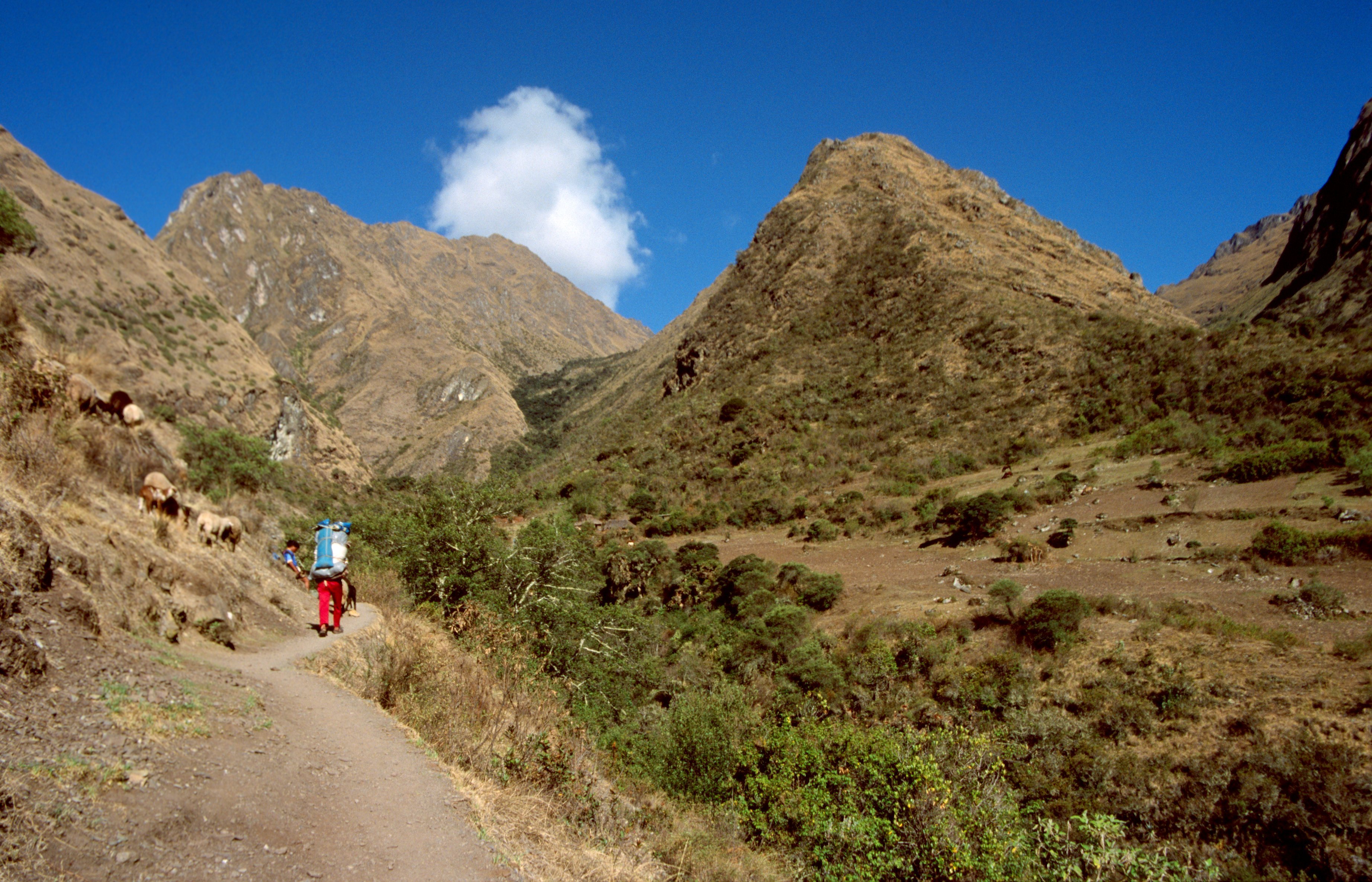
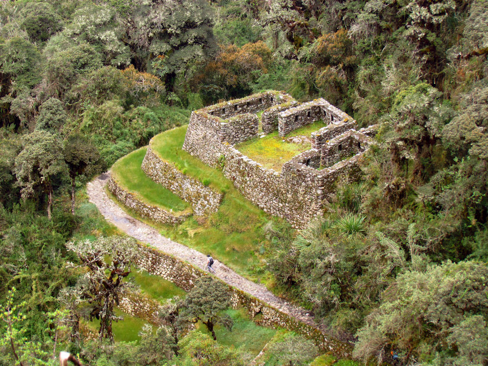
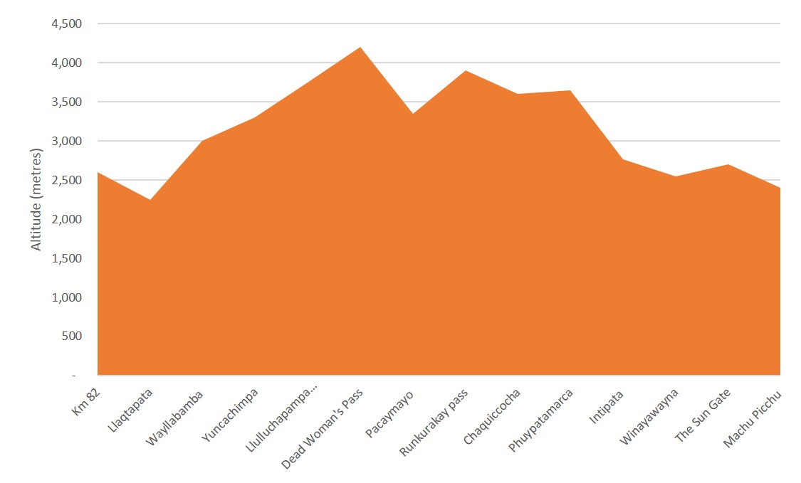
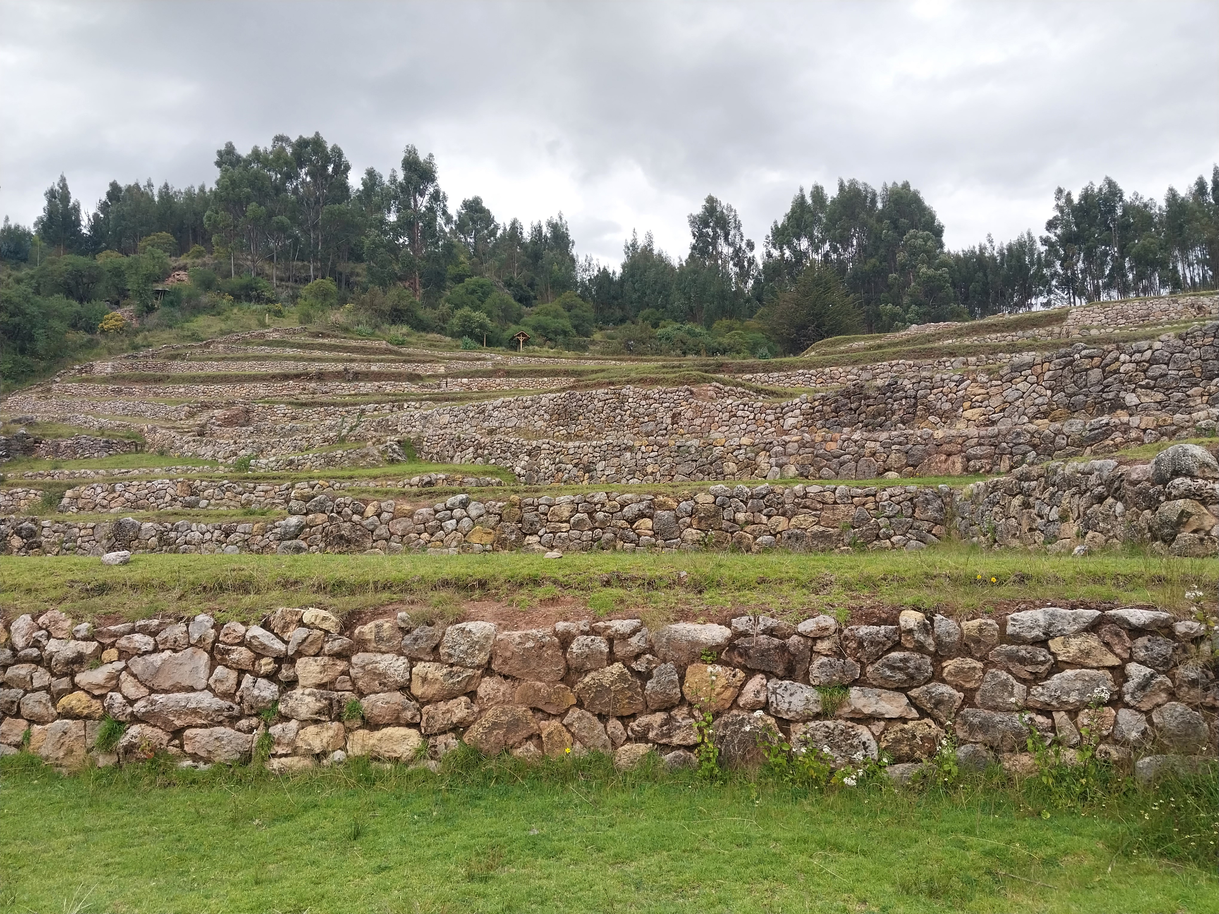
The Inca Trail to Machu Picchu is a historically significant hiking trail located in the Andes mountain range of Peru. This trail is known for its varied Andean environments, including cloud forests and alpine tundra. Along the route, trekkers encounter numerous Incan ruins, settlements, and tunnels. The trail features agricultural terraces, villages, and altars, showcasing the sophisticated land use and religious practices of the Inca civilization. The trail reaches its highest point at the Dead Woman's Pass, at 4,215 meters above sea level. The trail's historical significance is underscored by its connection to ancient Incan sites, including Patallaqta and Willkaraqay, with the latter dating back to around 500 BCE. Despite its popularity, the trail is carefully managed to prevent erosion and preserve its archaeological integrity.
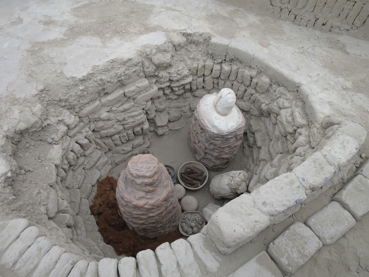
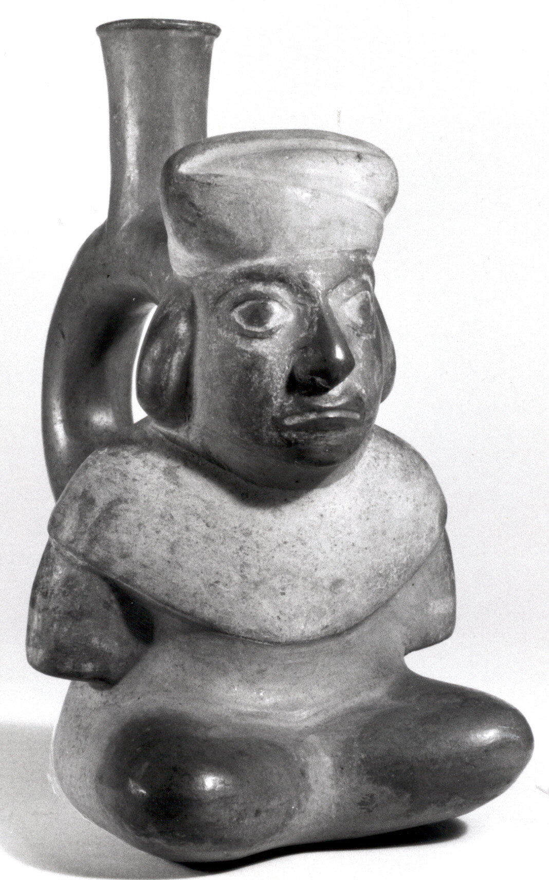
Gallery
Explore photographs of ancient structures, artifacts, and archaeological excavations
Historical Timeline
Journey through time and discover key events in this site's history
500 BCE Willkaraqay First Inhabited
500 BCE
Archaeological Features
Unique architectural and cultural elements found at this historical site
Religious and Ritual Structures
Agricultural and Land Use Features
Domestic and Habitation Structures
Environmental and Natural Features
Transportation and Communication Structures
Plan Your Visit
Tours, travel arrangements, and practical information


More Sites in Peru
Inkilltambo
Ancient Peruvian site with cultivated terrain.

Tunanmarca
Hilltop archaeological site with ancient structures
Buena Vista, Peru
Ancient temple complex with observatory in Peru

Tikra
Circular buildings and burial towers in Peru
Huaca Pucllana
Adobe pyramid with ceremonial and administrative areas
Tinyaq
Inca period storehouses on a mountain