Explore the Map
Burgstall Schlosshügel
49.9535° N, 11.7712° E
About
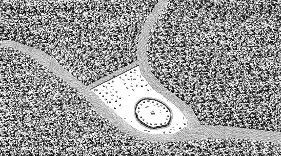
The Burgstall of Schlosshügel near Weidenberg is a lost hill castle or circular rampart site of the type known as a motte from the Early Middle Ages. It lies on the southern perimeter of the Fichtel Mountains at a height of 699 metres above sea level (NN) above the village of Sophienthal, which is part of the market borough of Weidenberg in the Upper Franconia county of Bayreuth in Bavaria. The burgstall or lost castle site was partly investigated by means of an archaeological test excavation and was also mapped several times in the past.
Historical Timeline
Journey through time and discover key events in this site's history
Architectural dating
early 11th century
Possible documentary mention
1412
First recorded sketch
1791
Early test excavation finds
1846
History Society excavations
1888/1889
Geodetic survey
1989
Archaeological Features
Unique architectural and cultural elements found at this historical site
Storage Structures
Defensive Structures
Military Installations
Public and Civic Structures
Industrial and Craft Structures
Domestic and Habitation Structures
Environmental and Natural Features
Transportation and Communication Structures
Frequently Asked Questions
Plan Your Visit
Tours, travel arrangements, and practical information
More Sites in Germany
Rochlitz Castle
Medieval castle with Romanesque architecture
Circular rampart of Burg
10th-century circular earthwork defensive structure
Blankenhagen Castle
Ruins of 13th-century motte-and-bailey castle
Reric
Slavic-Scandinavian Viking Age emporium remains
Asseburg (castle)
Largest hill castle in North Germany
Liubice
Medieval Slavic settlement with fortifications.