
Explore the Map
Dhanyawadi
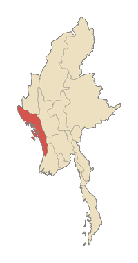
20.8748° N, 93.0681° E
About
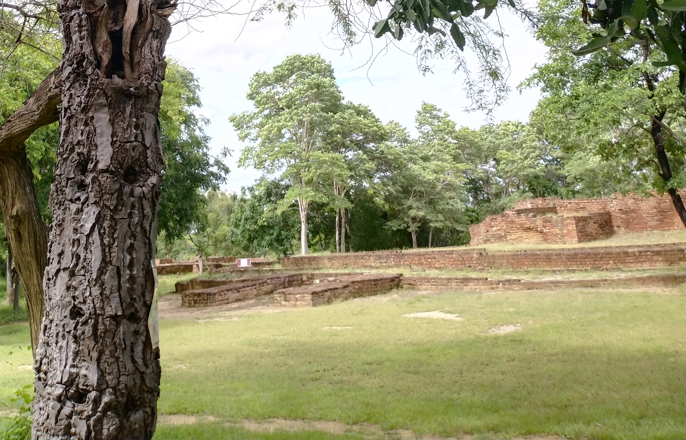
Dhanyawaddy (Burmese: ဓညဝတီ; Pali: Dhaññavatī) was the capital of the first Arakanese Kingdom, located in what is now Northern Rakhine State, Myanmar. The name is a corruption of the Pali word Dhannavati, which means "large area or rice cultivation or the rice bowl". Like many of its successors, the Kingdom of Dhanyawadi was based on trade between the East (pre-Pagan Myanmar, Pyu, China, the Mons), and the West (Indian subcontinent). The site is approximately 180 miles (290 km) north by north east of Sittwe, and lies between the Kaladan River and Thare Chaung (Thare Stream). Like much of Northern Rakhine State, it is in a hilly locale. Much of it is now deserted, with the only signs of civilisation being the stalls around the Mahamuni and meditation centres, opened to cater to the influx of pilgrims to the Mahamuni shrine (not the Mahamuni Image). The site can be reached by a one and a half to two hours bus ride from Mrauk U. Up until the mid-1950s, Dhanyawadi could also be reached by boat from the Thare Chaung, but pollution and silting has almost blocked the canal leading to the site. Its city walls were made of brick, and form an irregular circle with a perimeter of about 9.6 kilometres (6.0 mi), enclosing an area of about 4.42 square kilometres (1.71 sq mi). Remains of the city wall, and the palace compound are still visible. Beyond the walls, the remains of a wide moat, now silted over and covered by paddy fields, are still visible in places. The remains of brick fortifications can be seen along the hilly ridge which provided protection from the west. Within the city, a similar wall and moat enclose the palace site, which has an area of 0.26 square kilometres (0.10 sq mi), and another wall surrounds the palace itself. Aerial photographs indicate that Dhanyawadi's irrigation channels and storage tanks were centred at the palace site.
Gallery
Explore photographs of ancient structures, artifacts, and archaeological excavations
Historical Timeline
Journey through time and discover key events in this site's history
Legendary founding
before 6th century BCE
Boat access decline
mid-1950s
Estimated occupation
1st–6th century CE
Fall to the Burmese
1785
Archaeological Features
Unique architectural and cultural elements found at this historical site
Defensive Structures
Water Management Features
Public and Civic Structures
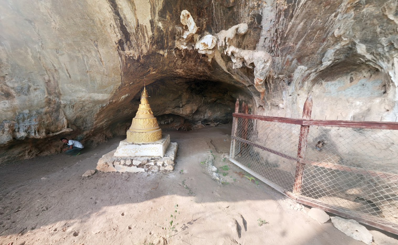
Religious and Ritual Structures
Artistic and Decorative Features
Agricultural and Land Use Features
Domestic and Habitation Structures
Environmental and Natural Features
Transportation and Communication Structures
Frequently Asked Questions
Plan Your Visit
Tours, travel arrangements, and practical information
More Sites in Myanmar
Beikthano
Fortified ancient Pyu city with stupas.
Waithali
Ruined capital city with Hindu influences.
Padah-Lin Caves
Limestone caves with ancient paintings and artifacts
Pyu Ancient Cities
<p>Pyu Ancient Cities includes the remains of three brick, walled and moated cities of Halin, Beikthano and Sri Ksetra located in vast irrigated landscapes…
Bagan
Lying on a bend of the Ayeyarwady River in the central plain of Myanmar, Bagan is a sacred landscape, featuring an exceptional range of Buddhist art and…