Rock Art of Alta
<p>This group of petroglyphs in the Alta Fjord, near the Arctic Circle, bears the traces of a settlement dating from c. 4200 to 500 B.C. The thousands of…
Explore the Map
Rock Art of Alta
69.9480° N, 23.1870° E
About
<p>This group of petroglyphs in the Alta Fjord, near the Arctic Circle, bears the traces of a settlement dating from c. 4200 to 500 B.C. The thousands of paintings and engravings add to our understanding of the environment and human activities on the fringes of the Far North in prehistoric times.</p>
Plan Your Visit
Tours, travel arrangements, and practical information
Details
Norway
69.95° N, 23.19° E
More Sites in Norway
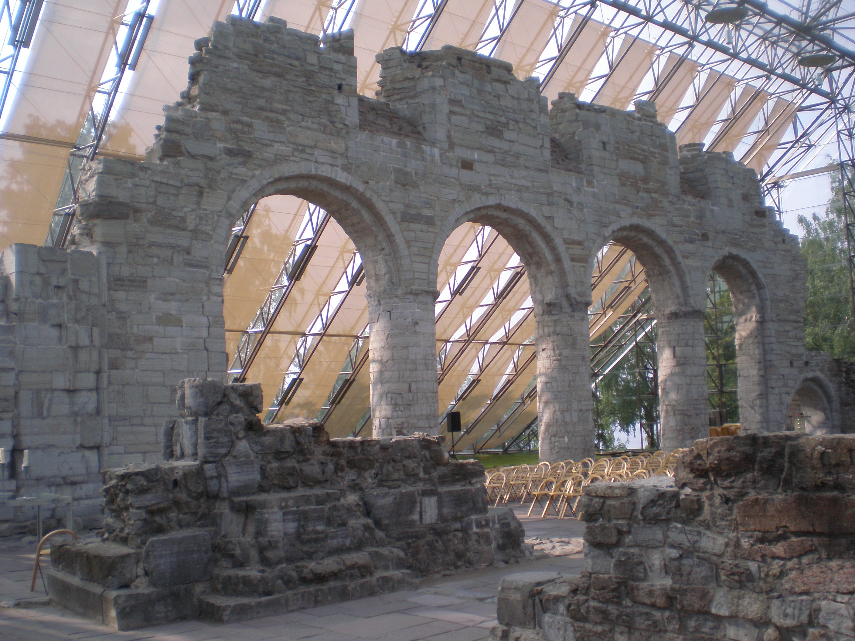
Cathedral Ruins in Hamar
Medieval Hamar Cathedral ruins in Norway
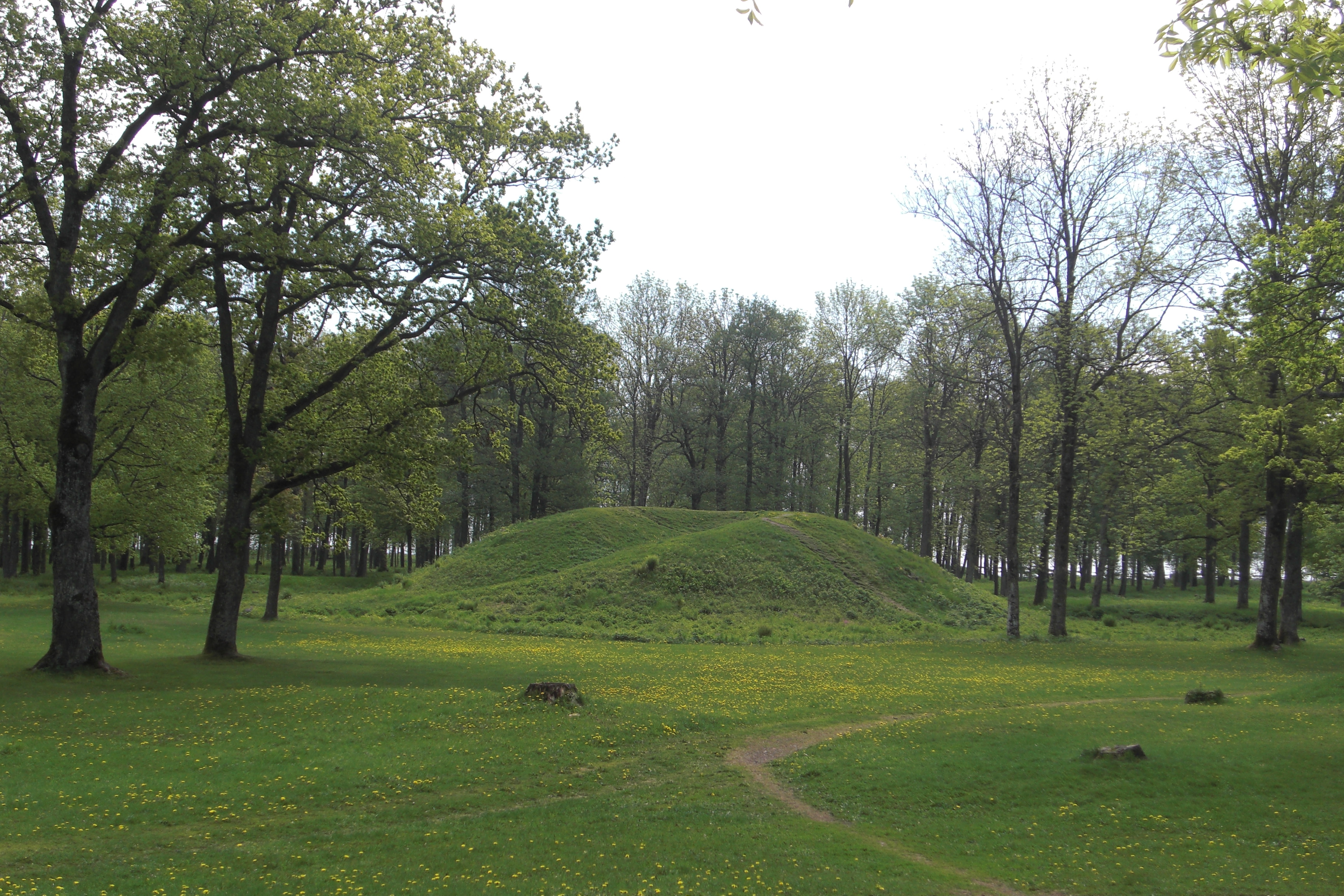
Borre mound cemetery
Scandinavian burial mounds and cairns site
Urnes Stave Church
<p>The wooden church of Urnes (the <em>stavkirke</em>) stands in the natural setting of Sogn og Fjordane. It was built in the 12th and 13th centuries and is…
Vegaøyan – The Vega Archipelago
<p>A cluster of dozens of islands centred on Vega, just south of the Arctic Circle, forms a cultural landscape of 107,294 ha, of which 6,881 ha is land. The…
Mølen
Mølen is a coastal geopark in the Brunlanes area of Larvik Municipality in Vestfold county, Norway.
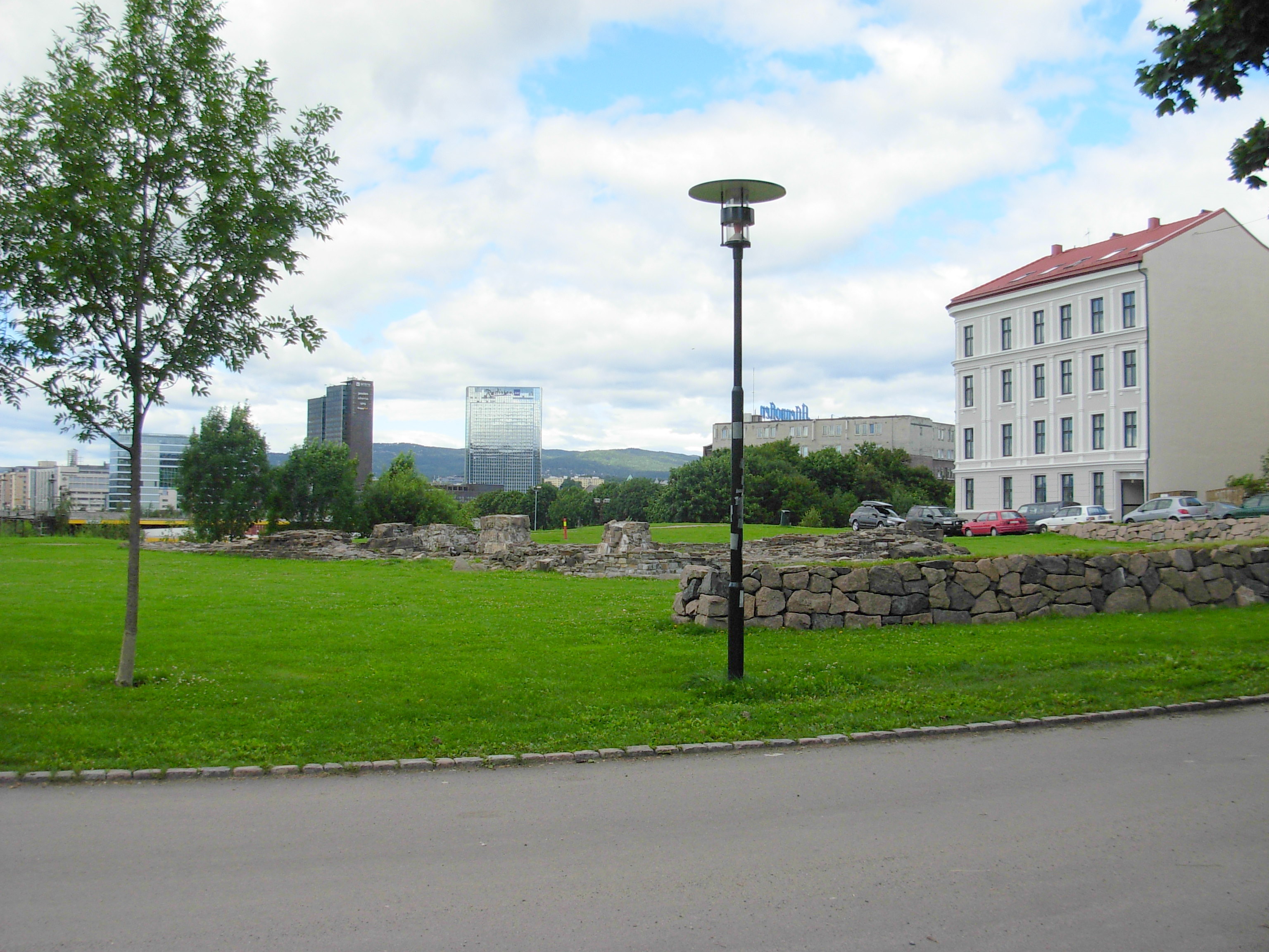
St. Clement's Church, Oslo
Ruins of medieval double-nave stone church