Frontiers of the Roman Empire – Dacia
<p>From 500 BCE on, the Roman Empire extended its territory across parts of Europe and North Africa until its frontier totaled some 7,500 kilometres by the…
Explore the Map
Frontiers of the Roman Empire – Dacia
43.7333° N, 24.9667° E
About
<p>From 500 BCE on, the Roman Empire extended its territory across parts of Europe and North Africa until its frontier totaled some 7,500 kilometres by the 2nd century. The Romanian segment, the Dacian Limes, was operational from 106 to 271 CE. The property comprises 277 component parts and represents the longest, most complex land border of a former Roman province in Europe. Traversing diverse landscapes, it is defined by a network of individual sites that include legionary fortresses, auxiliary forts, earthen ramparts, watch towers, temporary camps and secular buildings. Dacia was the only R
Plan Your Visit
Tours, travel arrangements, and practical information
Details
Oman
43.73° N, 24.97° E
More Sites in Oman
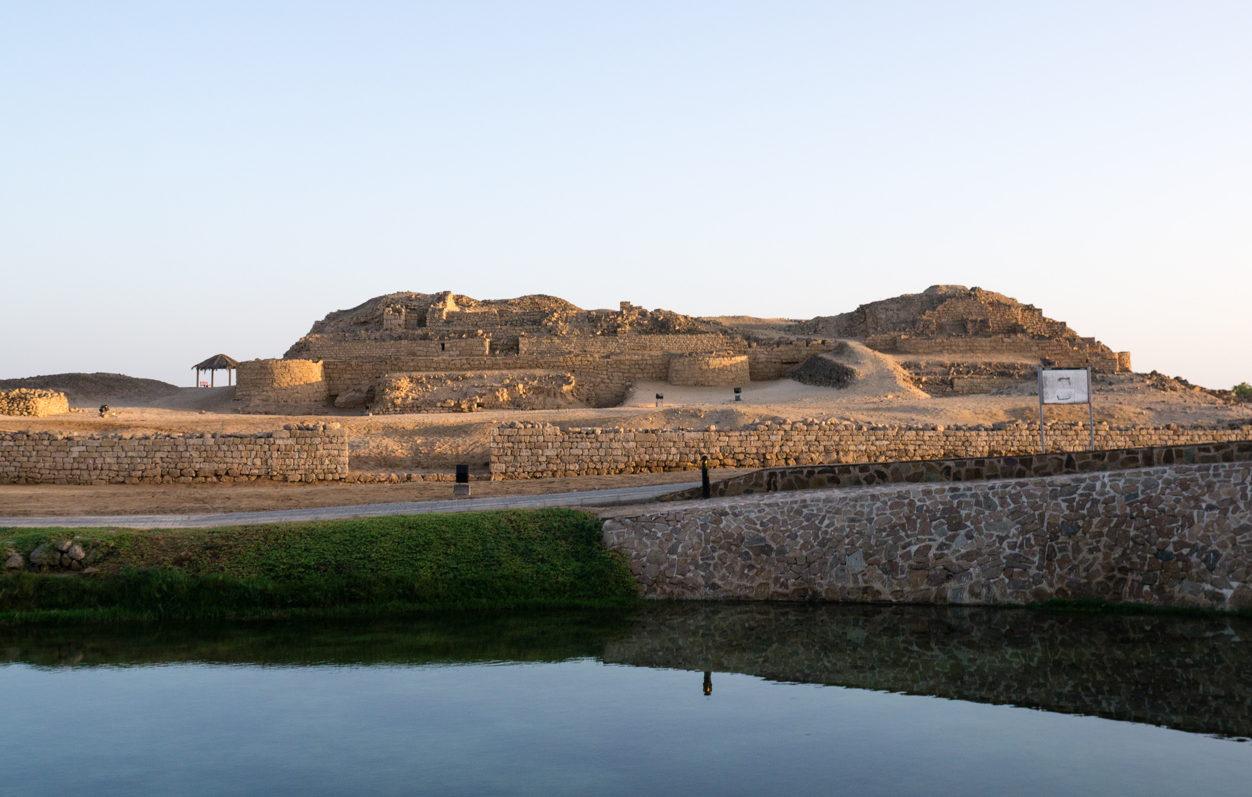
Land of Frankincense
Caravan oasis with frankincense trees.
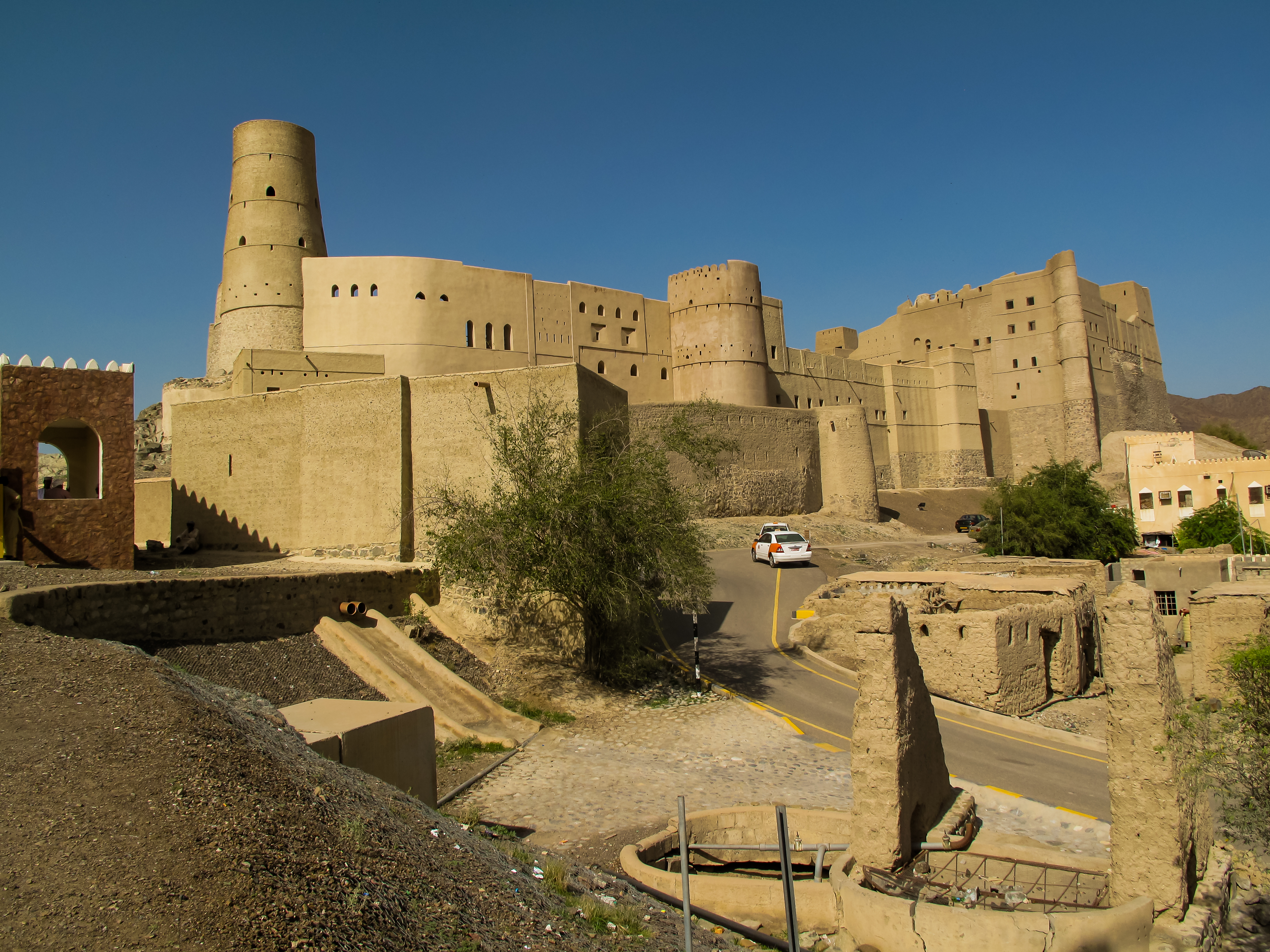
Bahla Fort
Historic mud-brick fort with ancient walls.
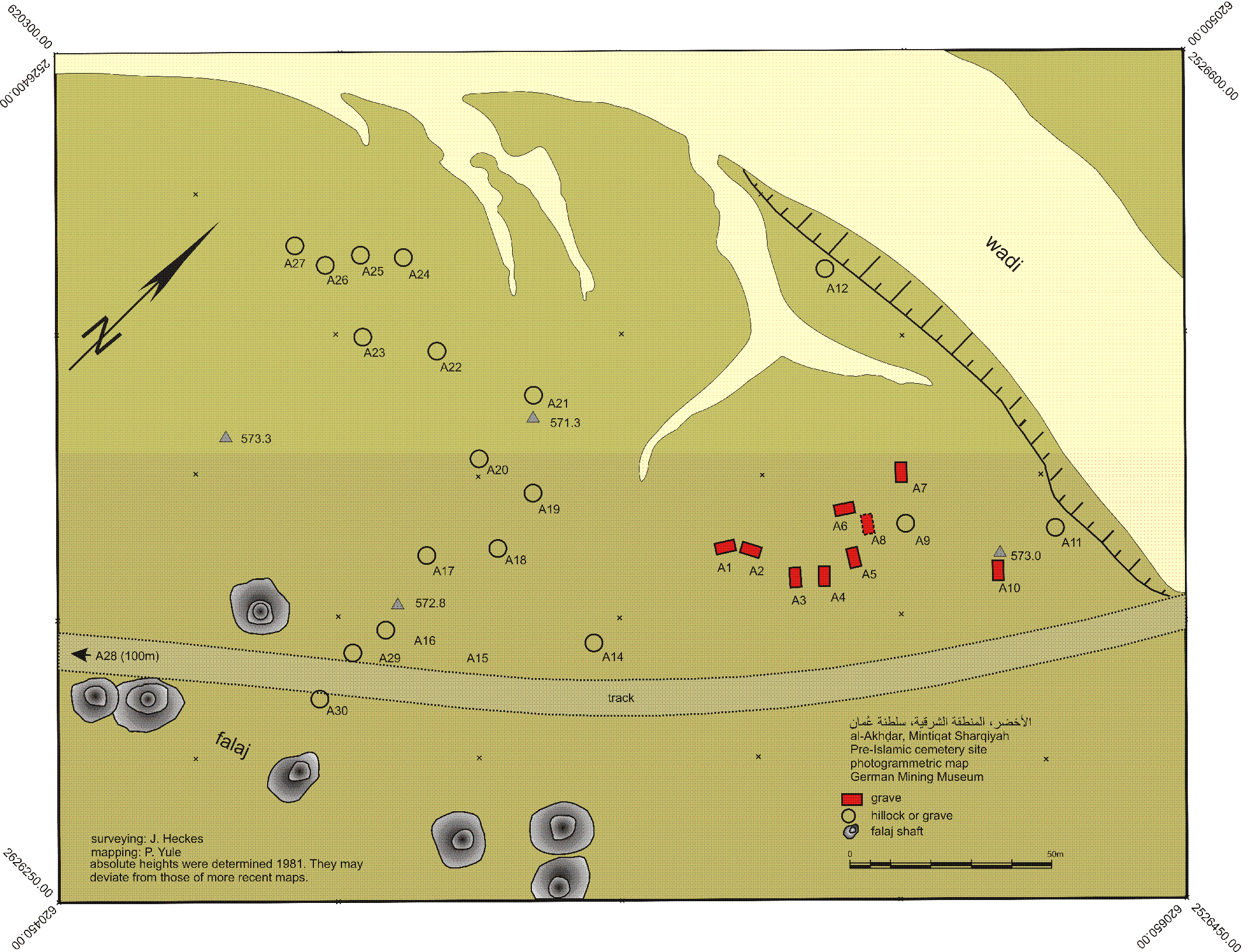
Al-Akhdhar
Cemetery with multiple period occupations
Wooden Churches of Maramureş
<p>These eight churches are outstanding examples of a range of architectural solutions from different periods and areas. They show the variety of designs…
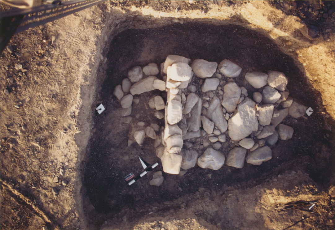
Samad al-Shan
Late Iron Age stone graves in Oman
Qaryat al-Saih
Fortified village with Late Iron Age origins