<i>Aflaj</i> Irrigation Systems of Oman
<p>The property includes five <em>aflaj</em> irrigation systems and is representative of some 3,000 such systems still in use in Oman. The origins of this…
Explore the Map
<i>Aflaj</i> Irrigation Systems of Oman
22.7333° N, 57.7667° E
About
<p>The property includes five <em>aflaj</em> irrigation systems and is representative of some 3,000 such systems still in use in Oman. The origins of this system of irrigation may date back to AD 500, but archaeological evidence suggests that irrigation systems existed in this extremely arid area as early as 2500 BC. Using gravity, water is channelled from underground sources or springs to support agriculture and domestic use. The fair and effective management and sharing of water in villages and towns is still underpinned by mutual dependence and communal values and guided by astronomical obs
Plan Your Visit
Tours, travel arrangements, and practical information
Details
Oman
22.73° N, 57.77° E
More Sites in Oman
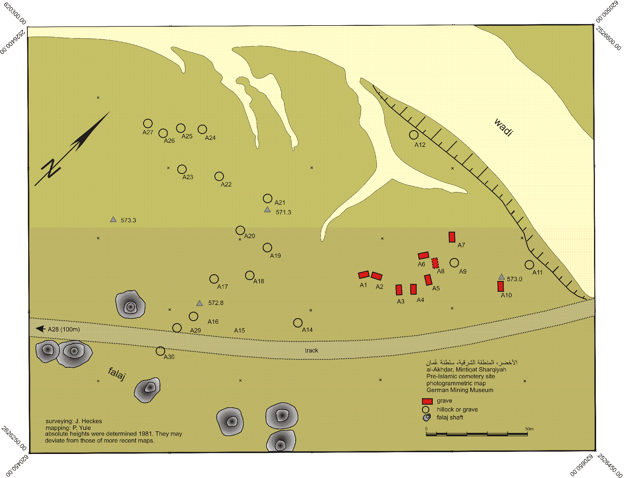
Al-Akhdhar
Cemetery with multiple period occupations
Frontiers of the Roman Empire – Dacia
<p>From 500 BCE on, the Roman Empire extended its territory across parts of Europe and North Africa until its frontier totaled some 7,500 kilometres by the…
Villages with Fortified Churches in Transylvania
<p>These Transylvanian villages with their fortified churches provide a vivid picture of the cultural landscape of southern Transylvania. The seven villages…
Land of Frankincense
Caravan oasis with frankincense trees.
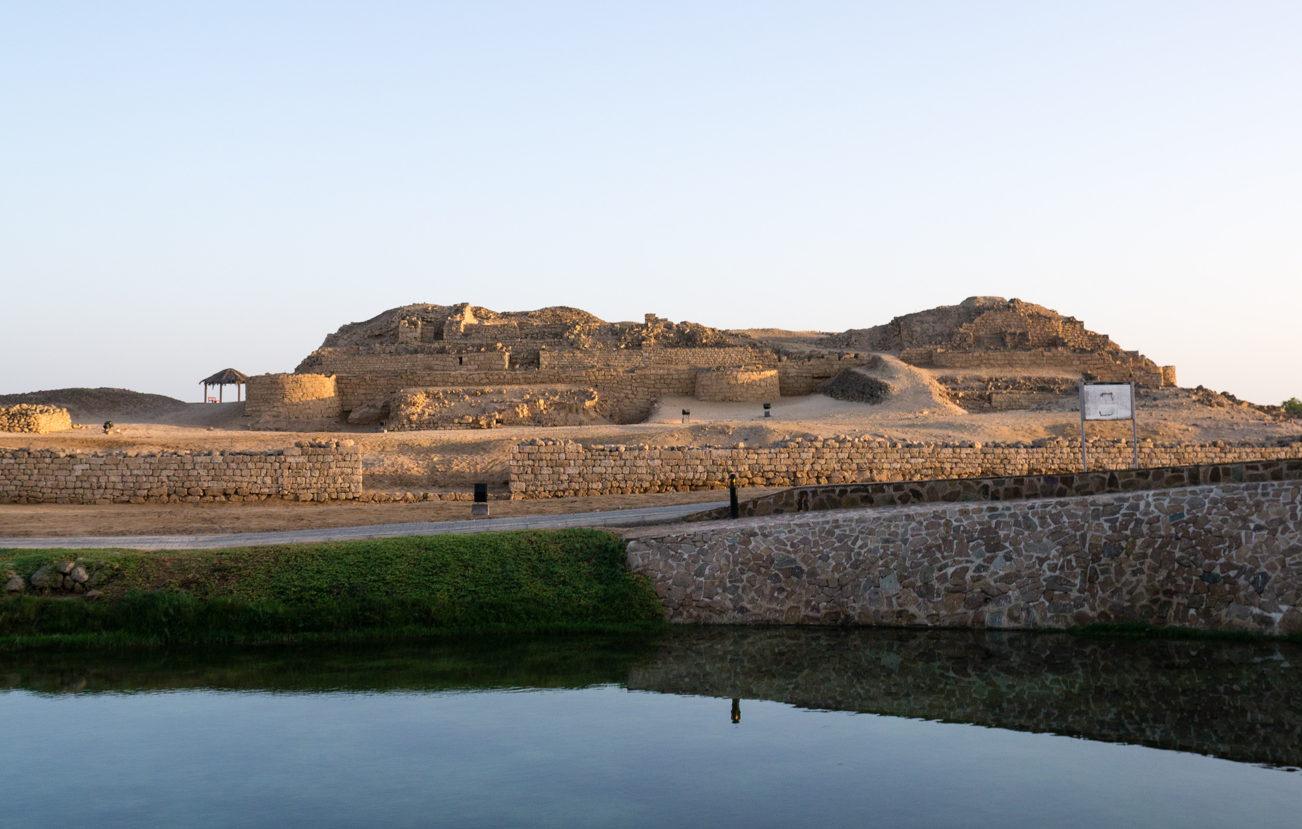
Al-Amqat
Unrobbed Late Iron Age cemetery in Oman
Wooden Churches of Maramureş
<p>These eight churches are outstanding examples of a range of architectural solutions from different periods and areas. They show the variety of designs…