Explore the Map
Freiha
25.9953° N, 51.0264° E
About
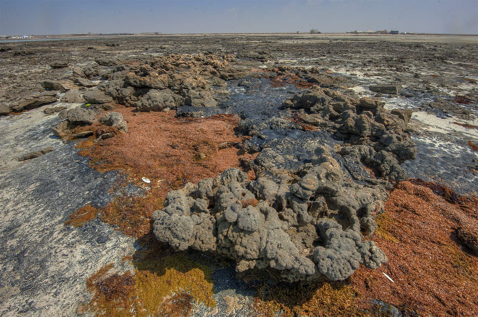
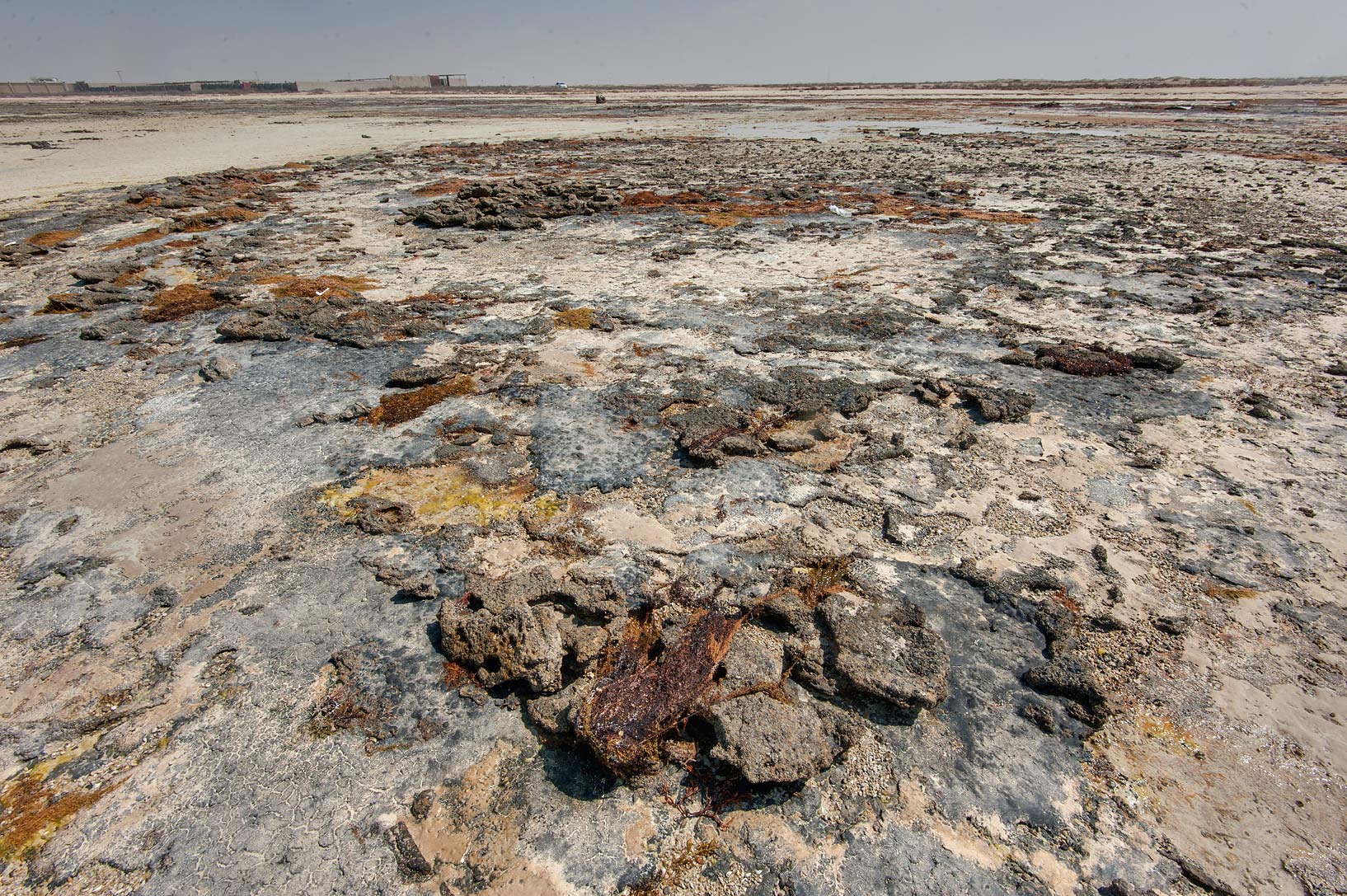
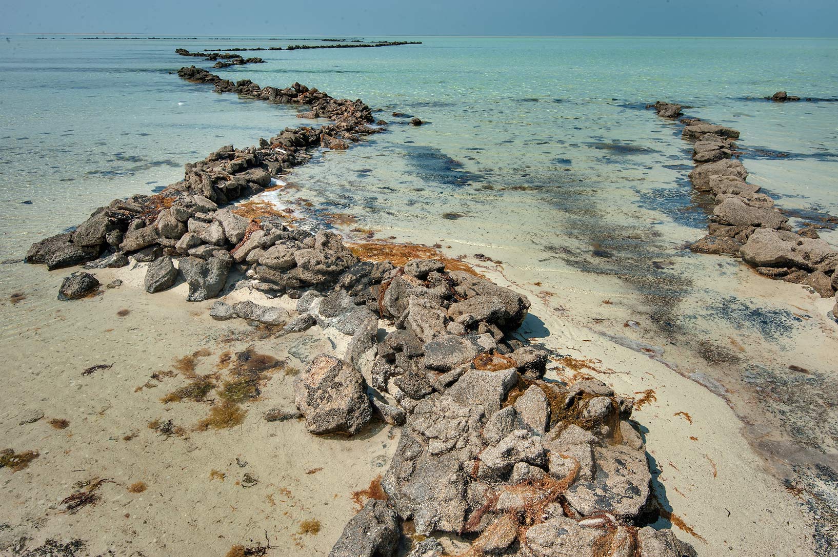
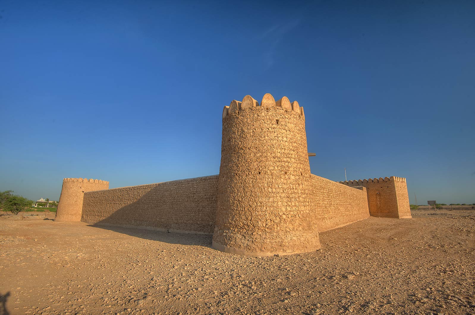
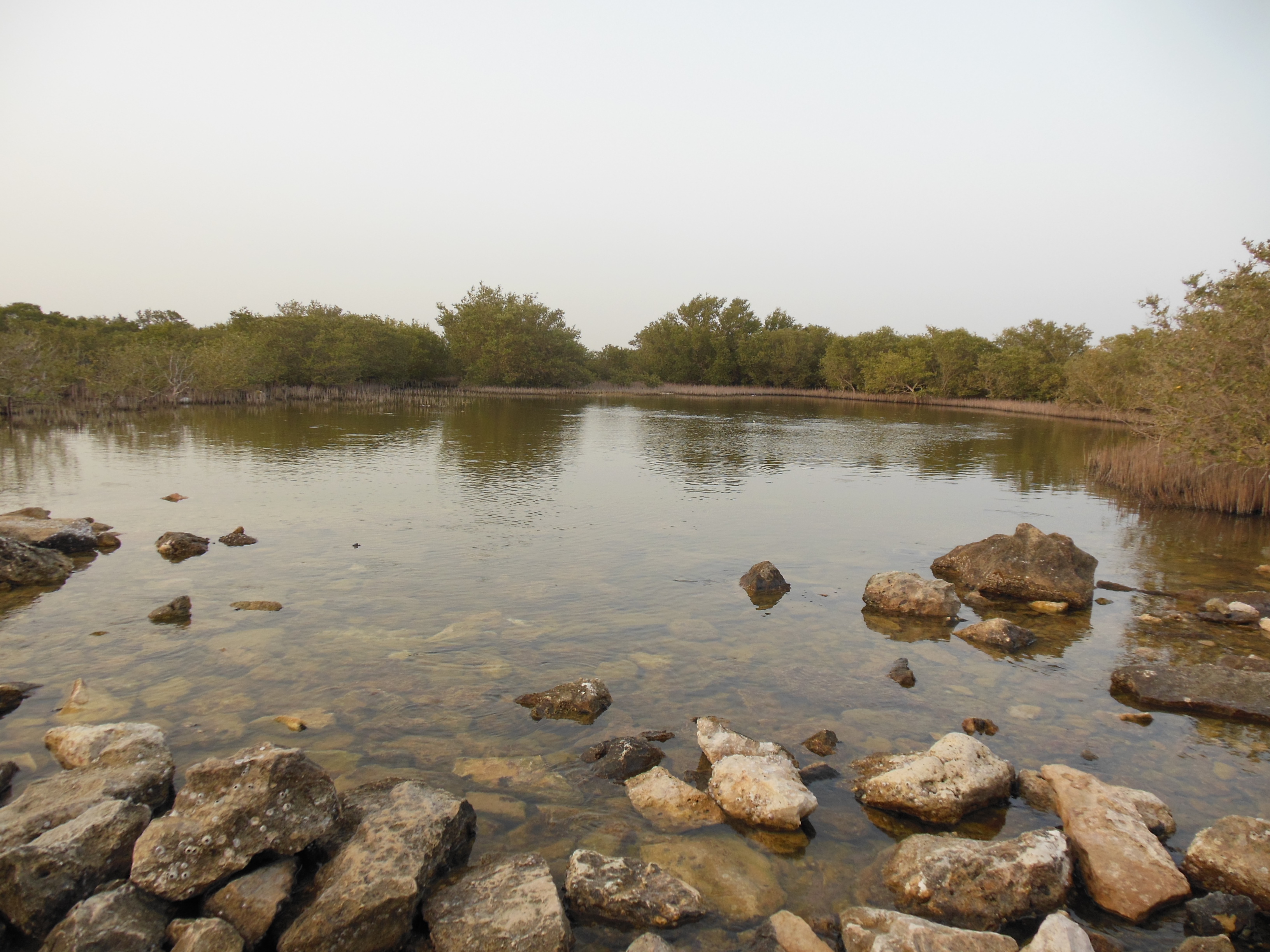
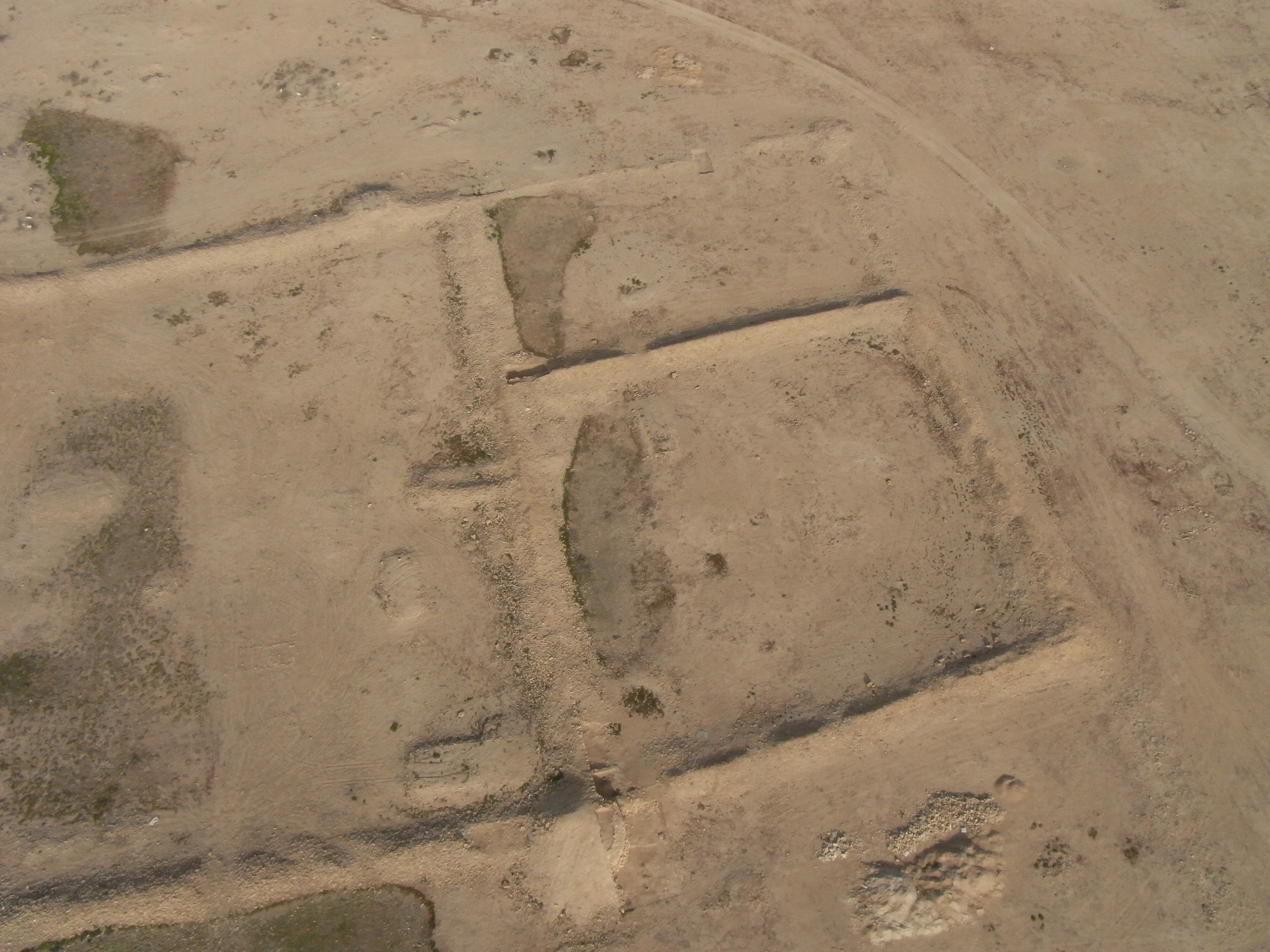
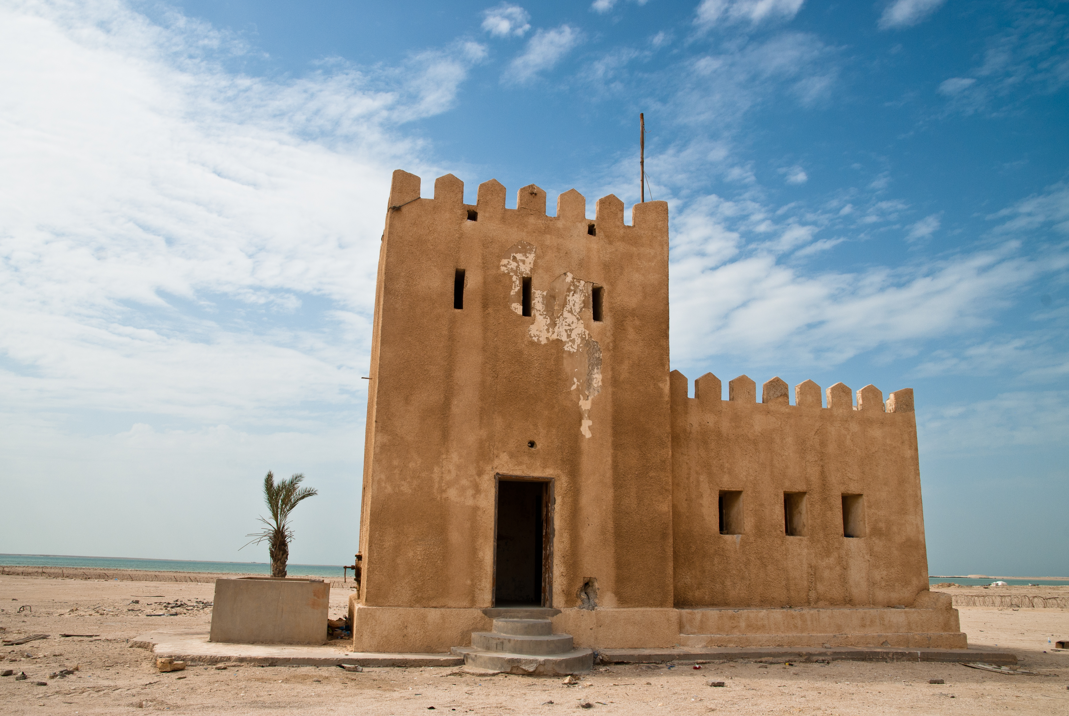
Freiha is an archaeological site located on the northwestern coast of the Qatar Peninsula, within the Al Shamal municipality. It comprises a deserted village that was once a flourishing settlement in the 17th and 18th centuries. The site covers an approximate area of 50 hectares and features domestic structures typical of the Persian Gulf region, including small stone-built houses and courtyards. A prominent fortified structure, Qal'at Freiha, and a mosque, with its distinct architectural elements, highlight the village's historical and cultural significance. The village's economy relied heavily on marine resources, evident from the presence of fishing implements and tidal fish traps. Additionally, Freiha is notable for its rock art, with numerous cup-marks and geometric designs attributed to ancient practices. These features, along with its strategic location, underscore Freiha's historical importance as a center of habitation and commerce.
Gallery
Explore photographs of ancient structures, artifacts, and archaeological excavations

Historical Timeline
Journey through time and discover key events in this site's history
17th century Freiha Peak
17th century CE
1732 Bani Utbah Settlement
1732 CE
July 1937 Al Thani Occupation
1937 CE
Archaeological Features
Unique architectural and cultural elements found at this historical site
Defensive Structures
Religious and Ritual Structures
Domestic and Habitation Structures
Environmental and Natural Features
Frequently Asked Questions
Plan Your Visit
Tours, travel arrangements, and practical information
More Sites in Qatar
Ath Thaqab
Abandoned village with historic fort and well.
Al Khor Island
Island with ancient dye industry and artifacts
Ruwayda
Large coastal archaeological site with fort
Yoghbi
Earliest Islamic-era settlement in Qatar.
Lehsain
Ruined village with Neolithic and 19th-century remains.
Umm Al Maa
Bronze Age cemetery with cairns and artifacts