Explore the Map
Carteia
36.1855° N, -5.4083° E
About
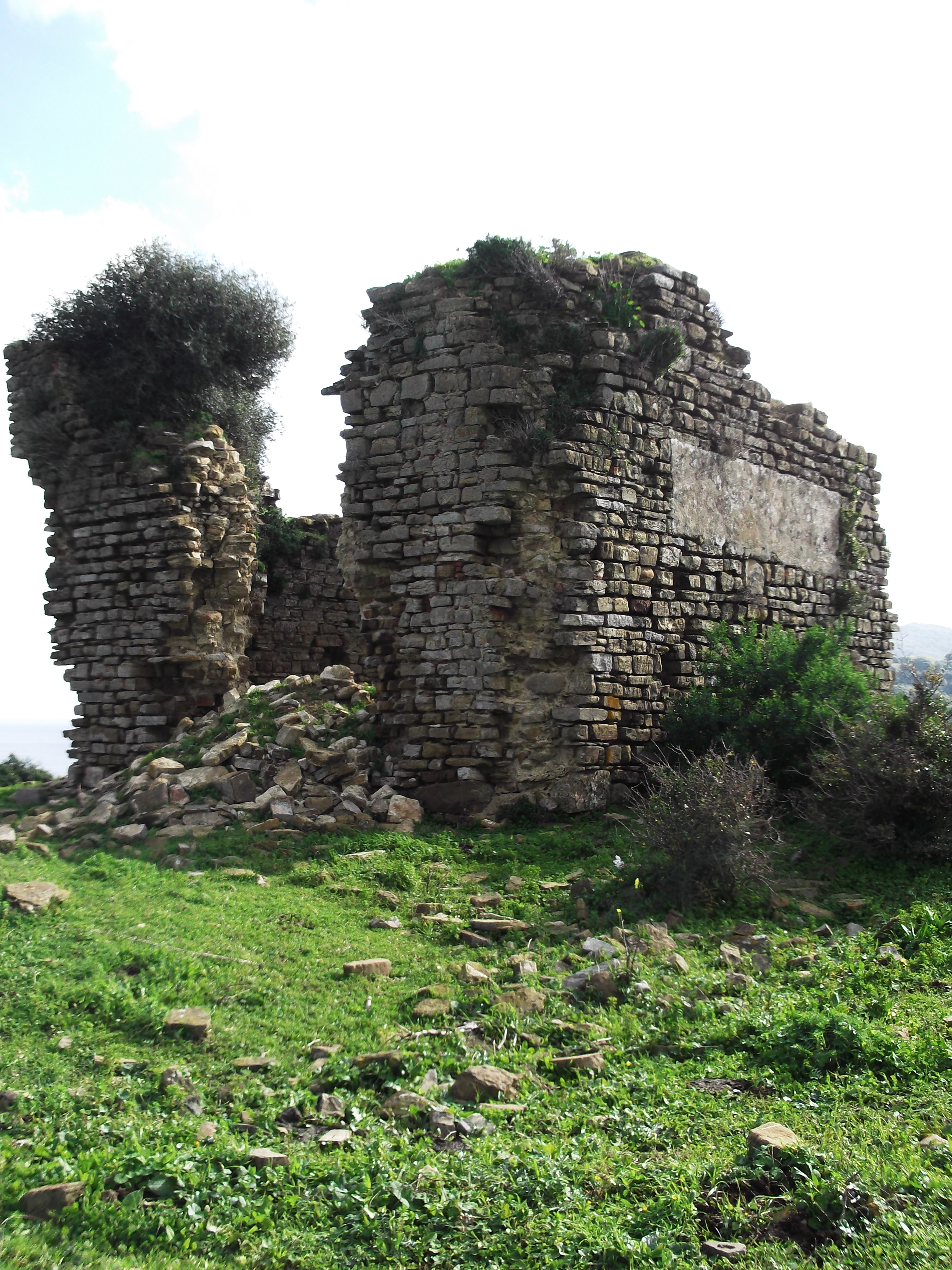
Carteia (Ancient Greek: Καρτηίᾳ) was a Phoenician and Roman town at the head of the Bay of Gibraltar in Spain. It was established at the most northerly point of the bay, next to the town of San Roque, about halfway between the modern cities of Algeciras and Gibraltar, overlooking the sea on elevated ground at the confluence of two rivers, nowadays called Guadarranque and Cachon. According to Strabo, it was founded around 940 BC as the trading settlement of Kʿrt (meaning "city" in the Phoenician language; compare Carthage and Cartagena). The area had much to offer a trader; the hinterland behind Carteia, in the modern south of Andalusia, was rich in wood, cereals, oranges, lemons, lead, iron, copper and silver. Dyes were another much sought-after commodity, especially those from the murex shellfish, used to make the prized Tyrian purple. Strabo and Pomponius Mela, mention that some believe that Carteia used to be the Tartessos. Pliny the Elder writes that Carteia was called by the Greeks Tartessos. The town's strategic location meant that it played a significant role in the wars between Carthage and the Roman Republic in the 2nd and 3rd centuries BC. It may have been the site of Hamilcar's landing with his army and elephants in 237 BC, and in 206 BC the Carthaginian admiral Adherbal retreated there with the remnants of his fleet after being defeated by Gaius Laelius in the Battle of Carteia. Around 190 BC, the town was captured by the Romans.
Historical Timeline
Journey through time and discover key events in this site's history
Byzantine province period
6th–7th centuries
Raising of soldiers by Pompey's sons
45 BC
Pompey's base against pirates
68 BC
Colonia established
171 BC
Capture by Rome
c. 190 BC
Battle of Carteia
206 BC
Hamilcar landing (possible)
237 BC
Sacked by Visigoths
c. 409 AD
Phoenician foundation
c. 940 BC
Torre de Rocadillo
16th century
Rediscovery by John Conduitt
1713–1717
Early 19th-century excavations
1811–1812
Modern excavations
1971–1974
Archaeological Features
Unique architectural and cultural elements found at this historical site
Storage Structures
Defensive Structures
Public and Civic Structures
Burial and Funerary Structures
Industrial and Craft Structures
Religious and Ritual Structures
Artistic and Decorative Features
Domestic and Habitation Structures
Food Production and Processing Features
Transportation and Communication Structures
Frequently Asked Questions
Plan Your Visit
Tours, travel arrangements, and practical information
More Sites in Spain
Castulo
Iberian town and Roman-era settlement in Andalusia, Spain
Castro de Borneiro
Iron Age castro in Galicia, Spain
La Olmeda
Late Antique Roman villa, Palencia, Spain
Calatrava la Vieja
Medieval fortress and town in Castile‑La Mancha, Spain
Torre del Arroyo del Lobo
Ruined medieval defensive tower in Spain
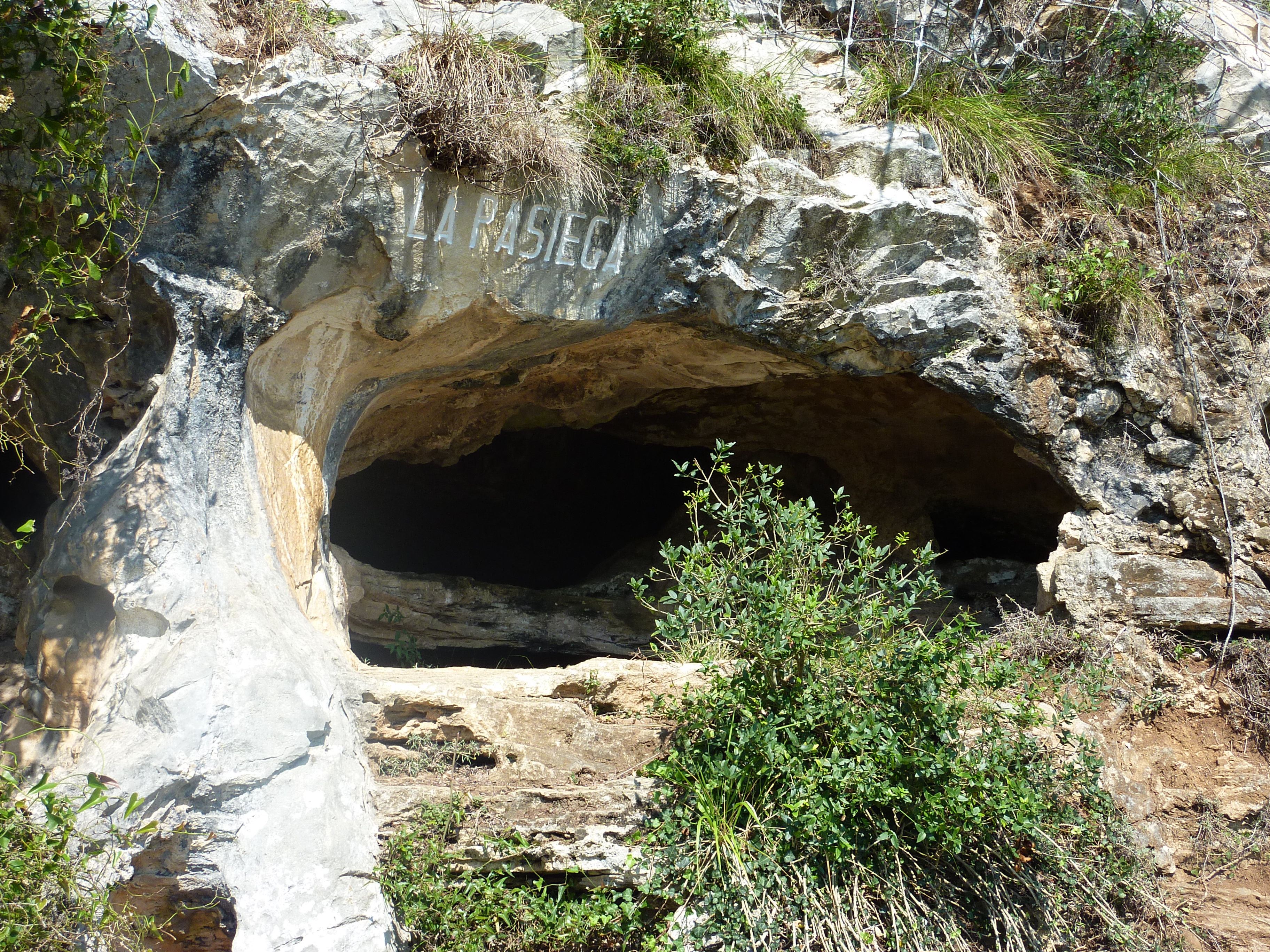
Cave of La Pasiega
Complex cave with Paleolithic rock art.