Explore the Map
Circular rampart of Burg
52.5853° N, 10.0916° E
About
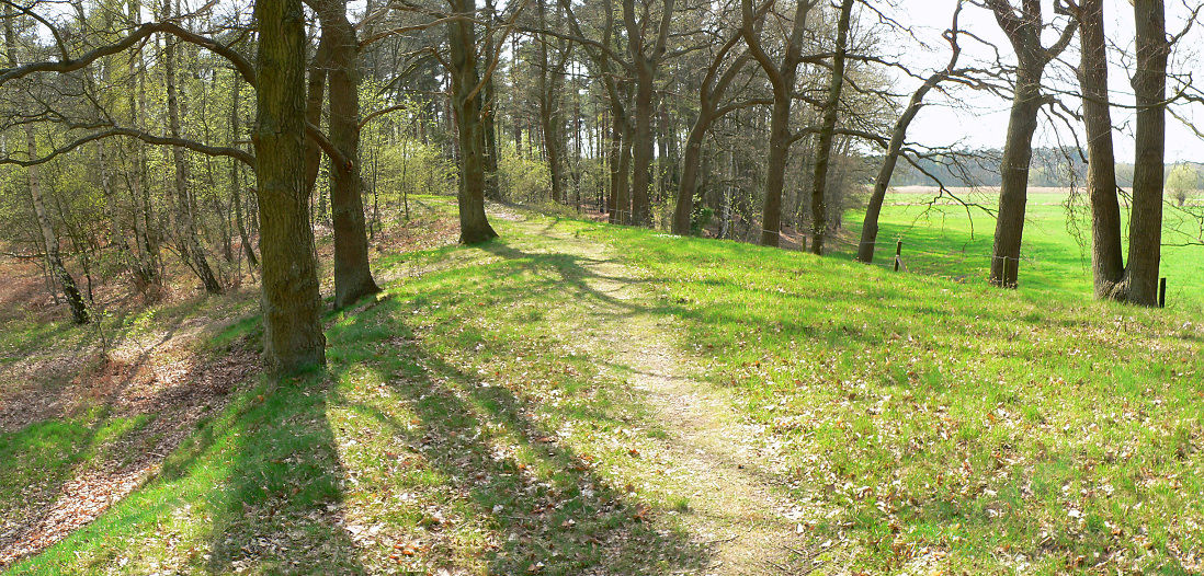
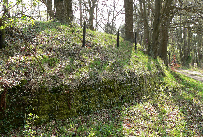
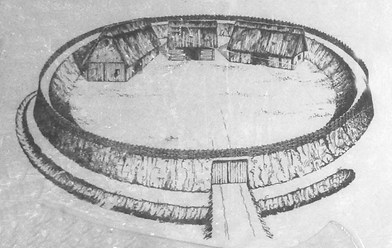
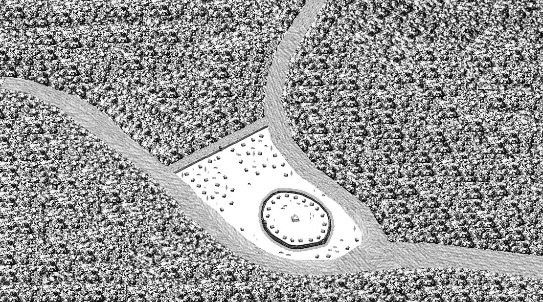
The Circular Rampart of Burg is a well-preserved 10th-century defensive earthwork located near Celle, Lower Saxony, Germany. This significant Early Middle Ages site features an almost perfectly circular embankment, measuring 70 to 85 meters in diameter and standing 3 meters high, constructed from plaggen or turf. It served as a refuge for the local population against potential Viking or Slav incursions. Excavations have uncovered evidence of a brief settlement period, with structures such as a hall, secondary building, and barn indicated by post sockets. Additionally, the site presents artifacts dating to the Stone Age, suggesting earlier human activity. The rampart's strategic location, coupled with its historical significance, underscores its importance as a defensive structure within the region.
Gallery
Explore photographs of ancient structures, artifacts, and archaeological excavations

Historical Timeline
Journey through time and discover key events in this site's history
Stone Age occupation evidence
Stone Age
10th century short settlement
10th century CE
10th century refuge construction
10th century CE
Archaeological Features
Unique architectural and cultural elements found at this historical site
Defensive Structures
Domestic and Habitation Structures
Frequently Asked Questions
Plan Your Visit
Tours, travel arrangements, and practical information
More Sites in Germany
Liubice
Medieval Slavic settlement with fortifications.
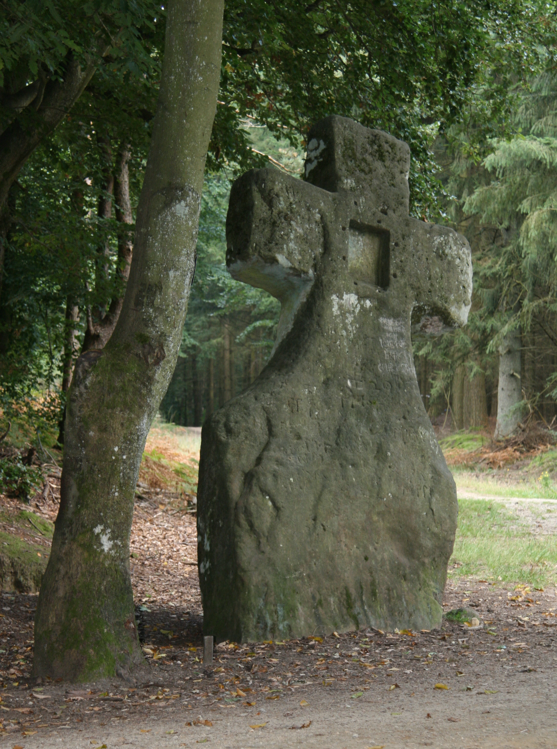
Fraubillen cross
Resculpted menhir into a Christian cross
Burgstall Schlosshügel
Early medieval motte (burgstall), Upper Franconia, Germany
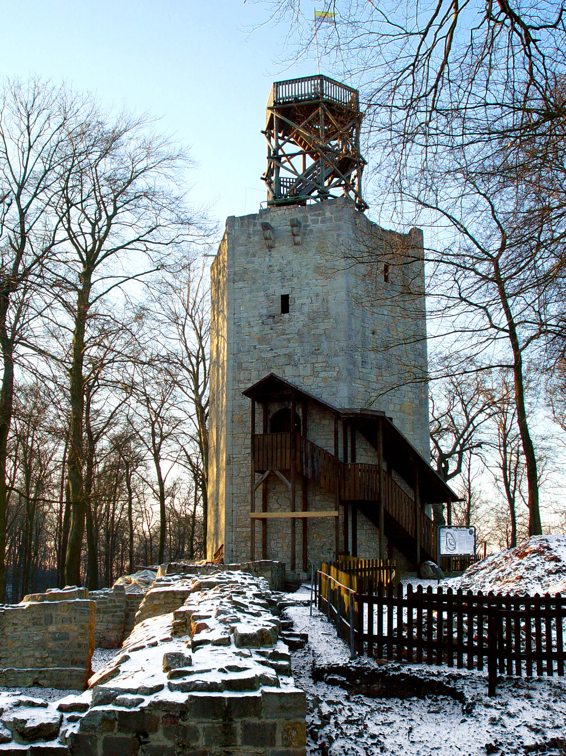
Lichtenberg Castle (Salzgitter)
12th-century hill castle ruins in Germany
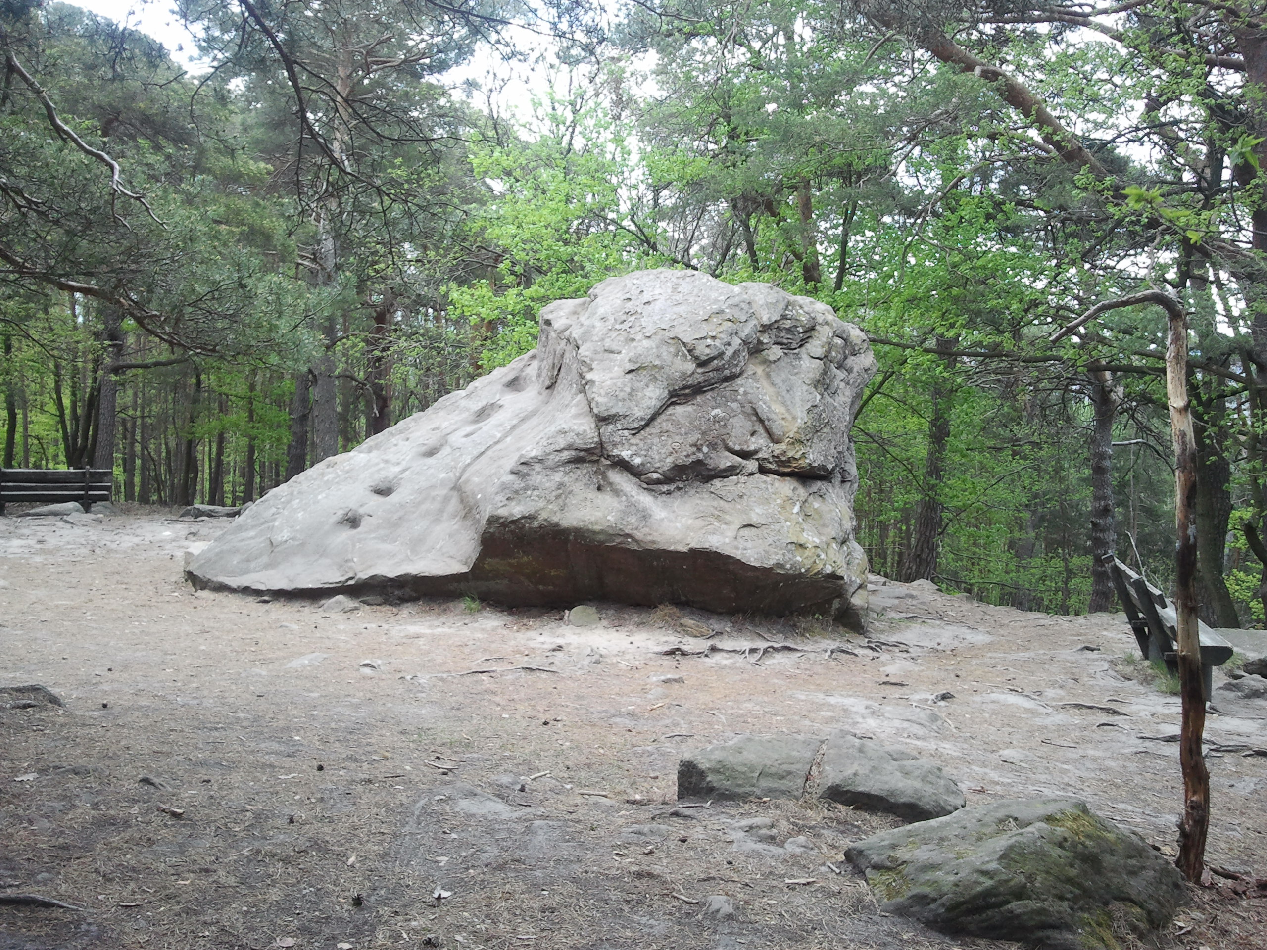
Teufelsstein (Haardt)
Monolith with Celtic and Roman carvings
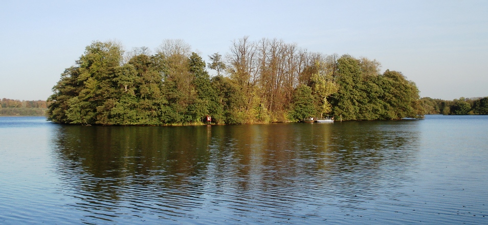
Pheasant Island (Eutin)
Small island with medieval castle ruins.