Explore the Map
Sacul, El Petén
16.5833° N, -89.3000° E
About
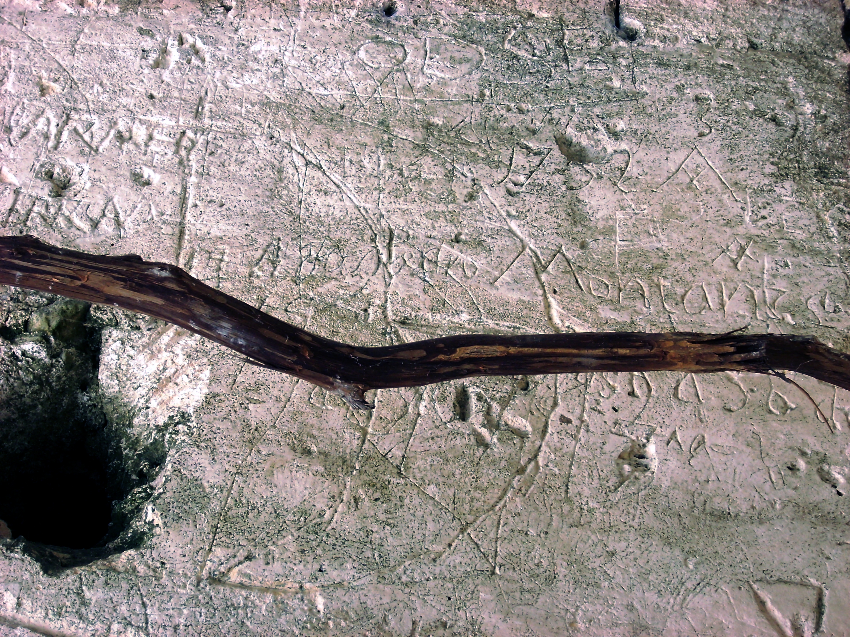
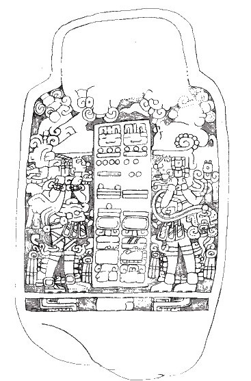
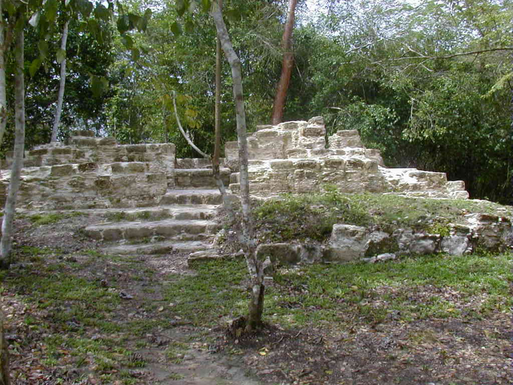
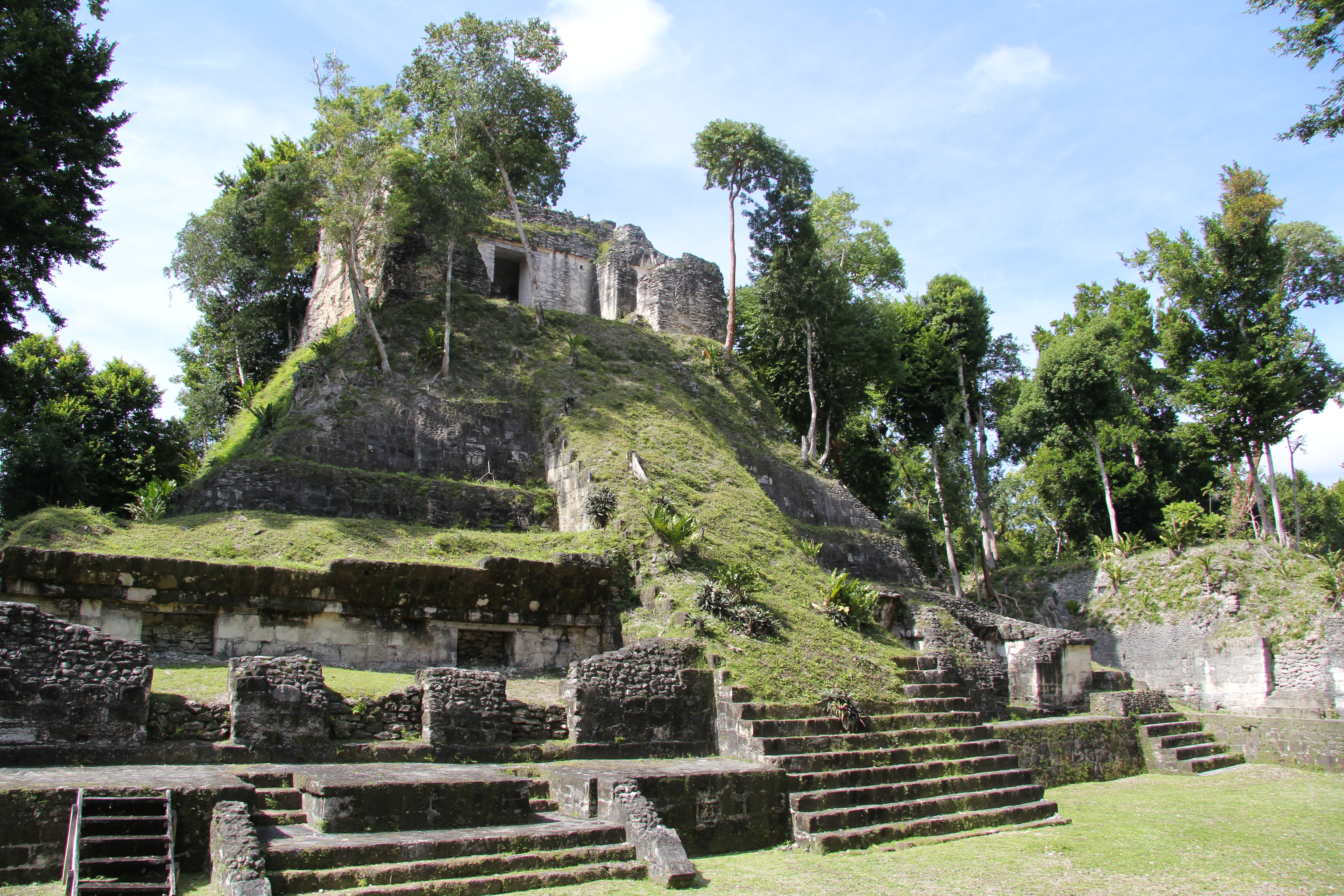
Sacul is an archaeological site of the Maya civilization located in the upper drainage of the Mopan River, in the Petén department of Guatemala. The city occupied an important trade route through the Maya Mountains. The main period of occupation dates to the Late Classic Period. In the late 8th century AD through to the early 9th century, Sacul was one of the few kingdoms in the southeastern Petén region to use its own Emblem Glyph, together with Ixtutz and Ucanal. In AD 779 Sacul went to war against Ixkun and lost, but stelae at both cities record a visit to Ixkun by king Ch'iyel of Sacul just 11 years later and the two cities appear to have formed a military alliance at that time. The site core is arranged around a number of plazas, one of which forms a monumental acropolis. The plazas were resurfaced in the Terminal Classic, when the city experienced a period of dense occupation. At this time Sacul experienced a major surge in construction activity, with many buildings being extended or altered. Sacul was inhabited into the Postclassic Period at a much reduced level, although it is not known if this represents a continuation of Classic Period occupation. This final phase of activity was spread throughout both the ceremonial core and the residential periphery and ceramic finds demonstrate links to the Belize Valley and the southern area of the Maya Mountains. The site core includes pyramids, a ballcourt, a triadic complex and two E-Group astronomical complexes.
Historical Timeline
Journey through time and discover key events in this site's history
Alliance with Ixkun
11 October 790
Mannequin sceptre ceremony
12 February 760
Battle with Ixkun
21 December 779
Monument production period
AD 760–820
Last recorded monument
AD 800
Archaeological Features
Unique architectural and cultural elements found at this historical site
Public and Civic Structures
Burial and Funerary Structures
Religious and Ritual Structures
Artistic and Decorative Features
Environmental and Natural Features
Astronomical and Timekeeping Structures
Transportation and Communication Structures
Frequently Asked Questions
Plan Your Visit
Tours, travel arrangements, and practical information


More Sites in Guatemala
La Blanca, Peten
Mesoamerican site with acropolis and plazas
Takalik Abaj
Large Mesoamerican site with Olmec-Maya features.
El Pilar
Ancient Maya city with plazas and temples
Motul de San José
Significant Maya civic-ceremonial center.
Xultun
Large Classic Maya archaeological complex
Nakum
Restored Maya site with monumental architecture.