
Explore the Map
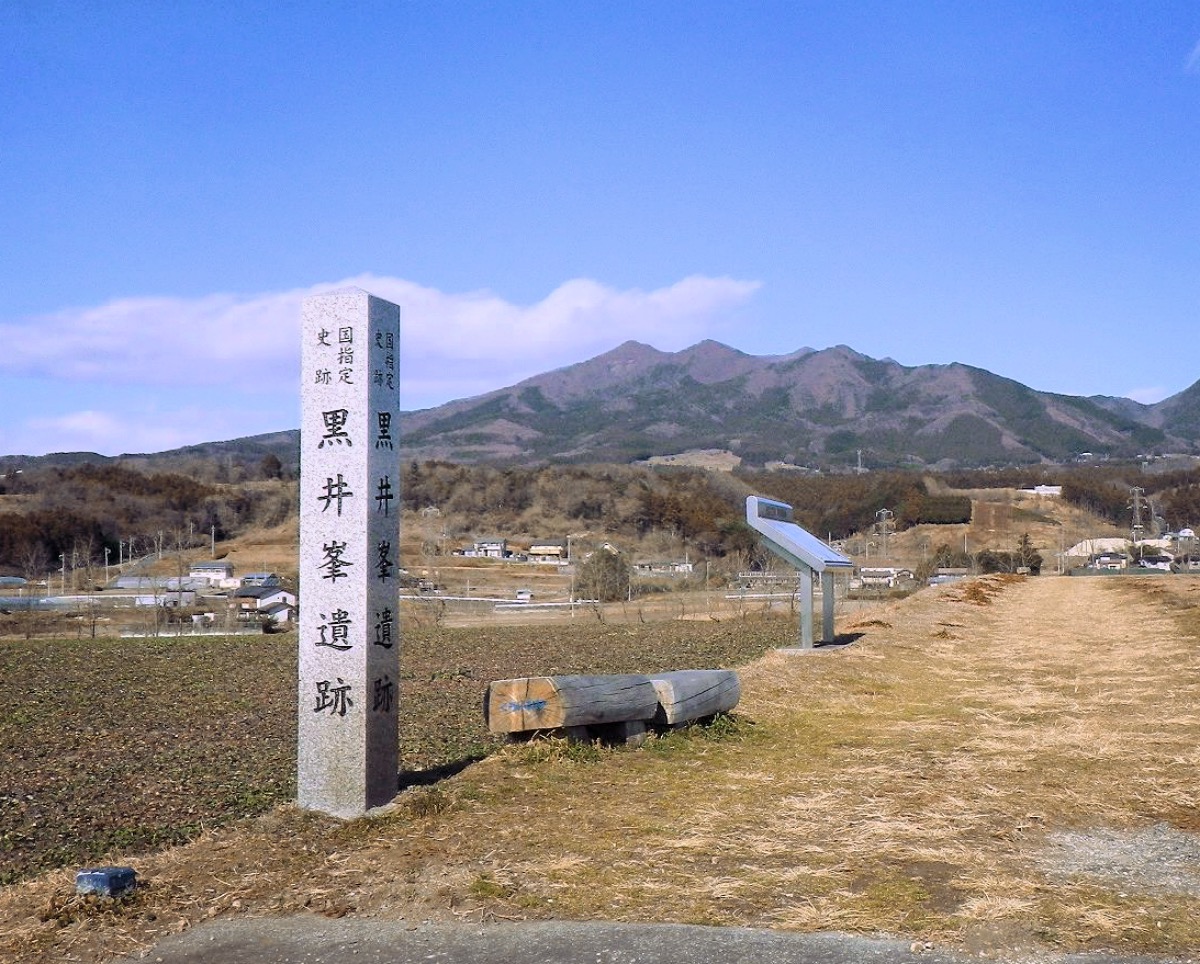
Kuroimine Site
36.5295° N, 139.0022° E
About
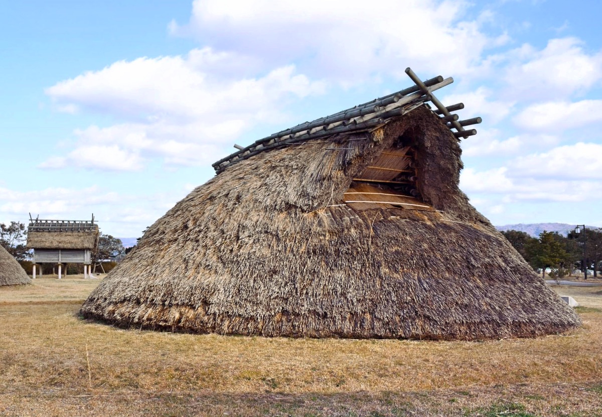
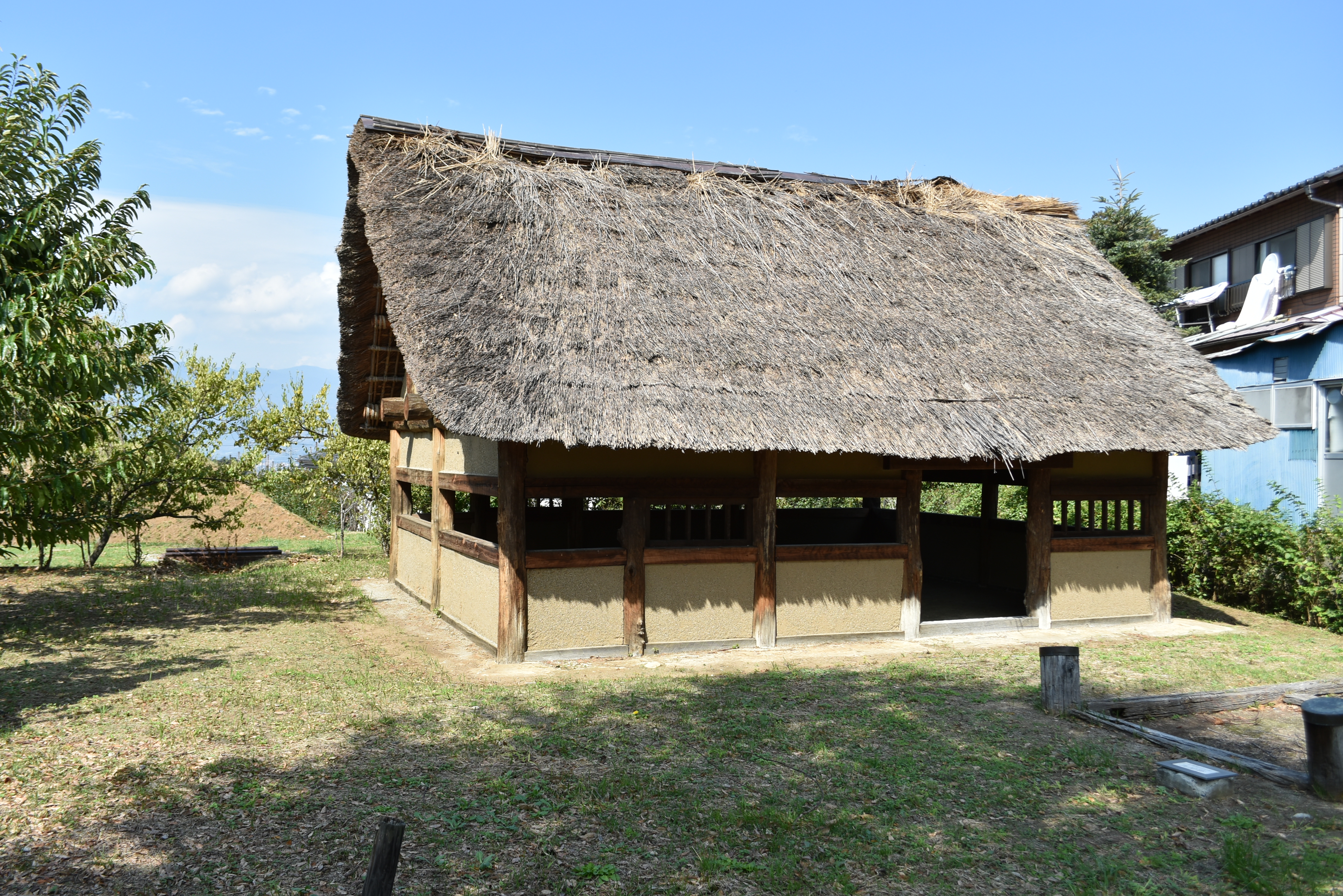
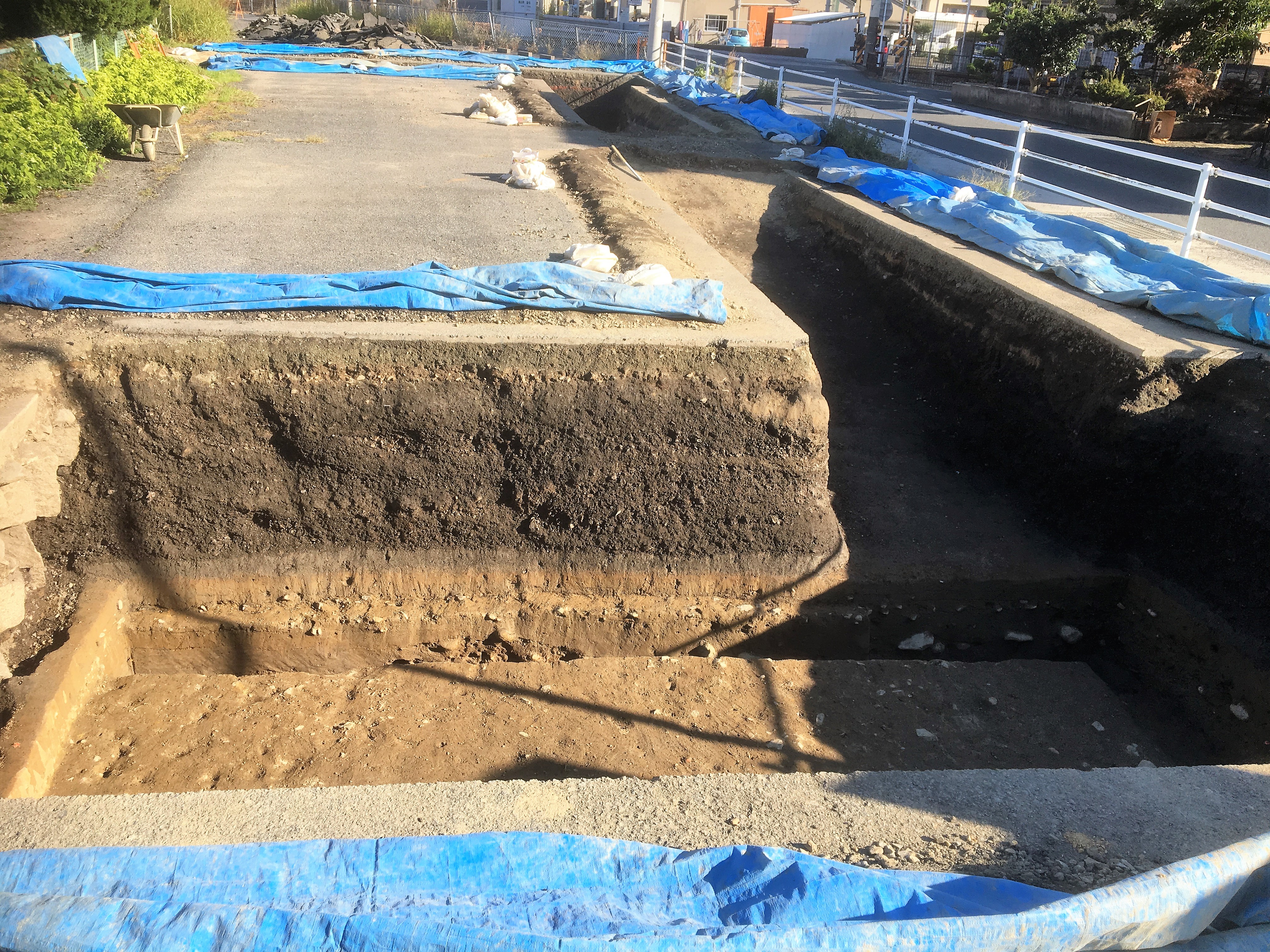
The Kuroimine Site, located in Shibukawa, Gunma Prefecture, Japan, is an important archaeological site from the Kofun period, dating to around the mid-6th century CE. This settlement was remarkably preserved under a layer of pumice and volcanic ash following an eruption of Mount Haruna, providing a unique snapshot of life during this era. Excavations revealed well-defined pit dwellings, raised-floor granaries, and livestock enclosures, suggesting a structured community with both agricultural and pastoral practices. The site offers insights into domestic architecture and community organization, showcasing a blend of paddy field agriculture and animal husbandry. The discovery of roads and garden traces indicates a well-planned settlement structure. Designated as a National Historic Site of Japan, Kuroimine provides valuable information on the social and economic aspects of the late Kofun period.
Gallery
Explore photographs of ancient structures, artifacts, and archaeological excavations
Historical Timeline
Journey through time and discover key events in this site's history
Kofun period settlement
500 CE
Archaeological Features
Unique architectural and cultural elements found at this historical site
Storage Structures
Animal Husbandry Features
Agricultural and Land Use Features
Domestic and Habitation Structures
Transportation and Communication Structures
Frequently Asked Questions
Plan Your Visit
Tours, travel arrangements, and practical information
More Sites in Japan
Yoshizaki-Suba Site
Yayoi period settlement remains, Ishikawa, Japan.
Katsunuma clan residence ruins
Sengoku period fortified residence ruins.
Bingo Provincial Capital
Ruins of ancient provincial capital structures

Komaru Castle
Sengoku period castle with moats and ramparts.
Mangyō Site
Late Yayoi–Early Kofun settlement, Nanao (Ishikawa), Japan
Furushida-Higashi ruins
Heian period fortified residence with moat.