
Explore the Map
Nazca lines
-14.6975° N, -75.1350° E
About
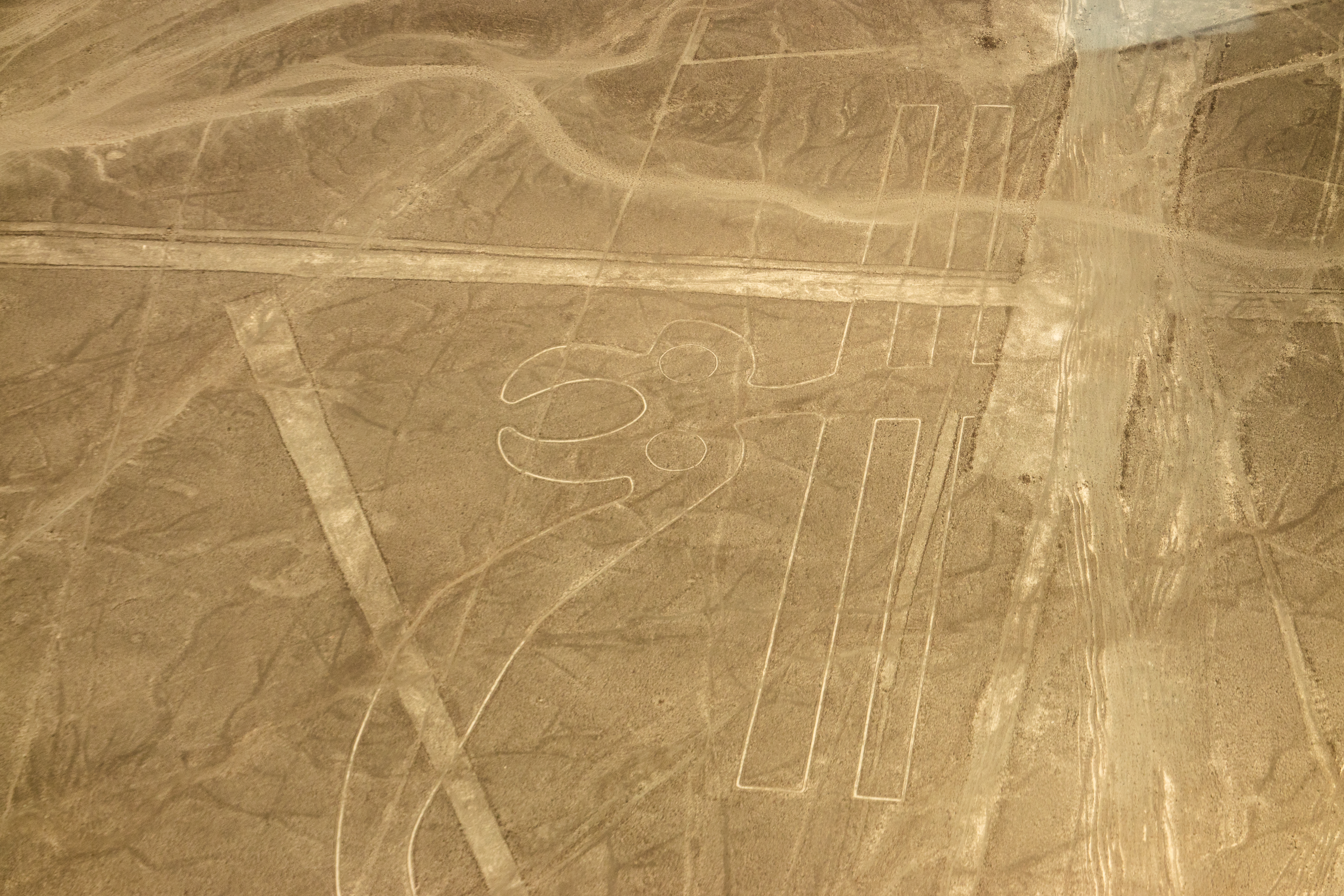
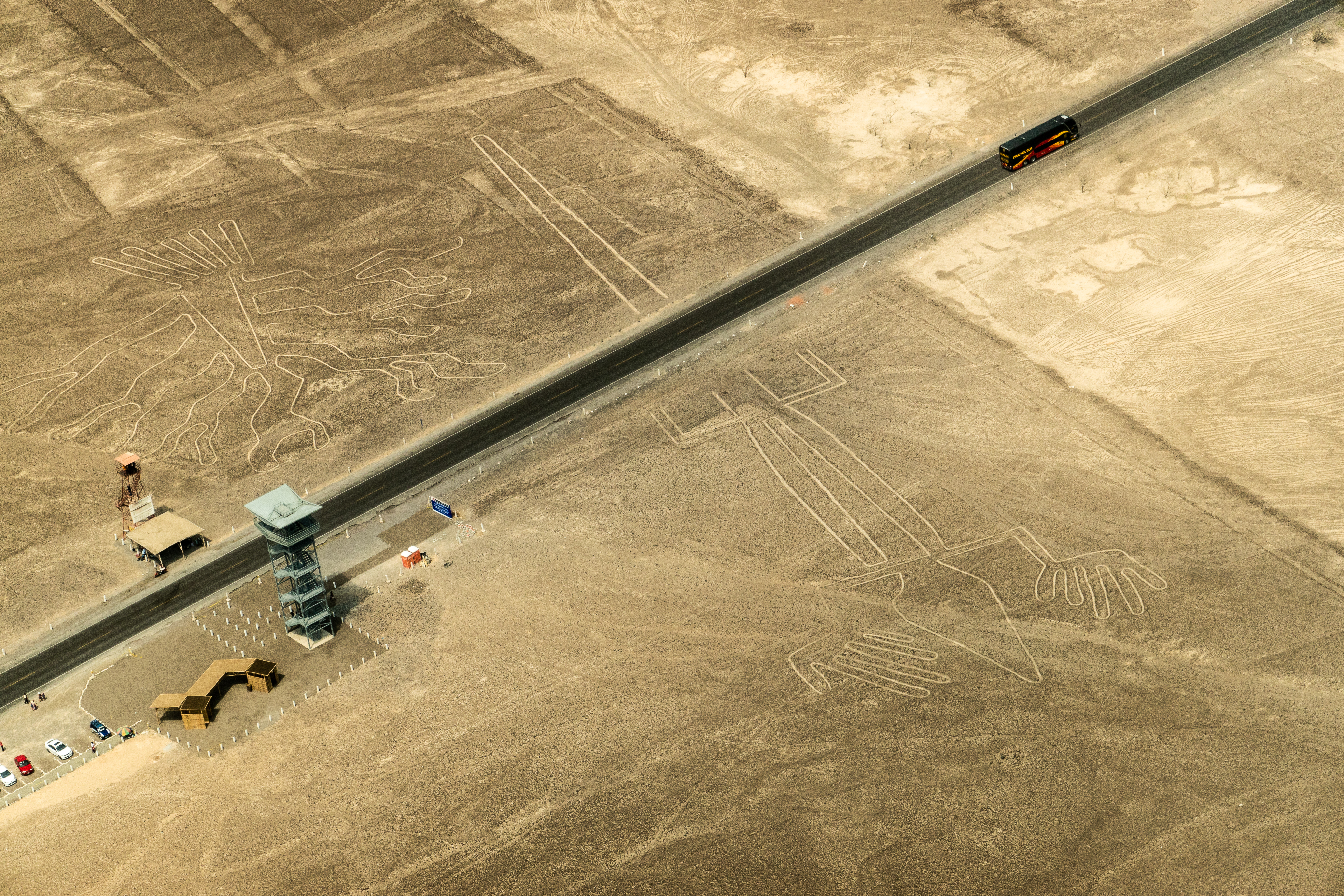
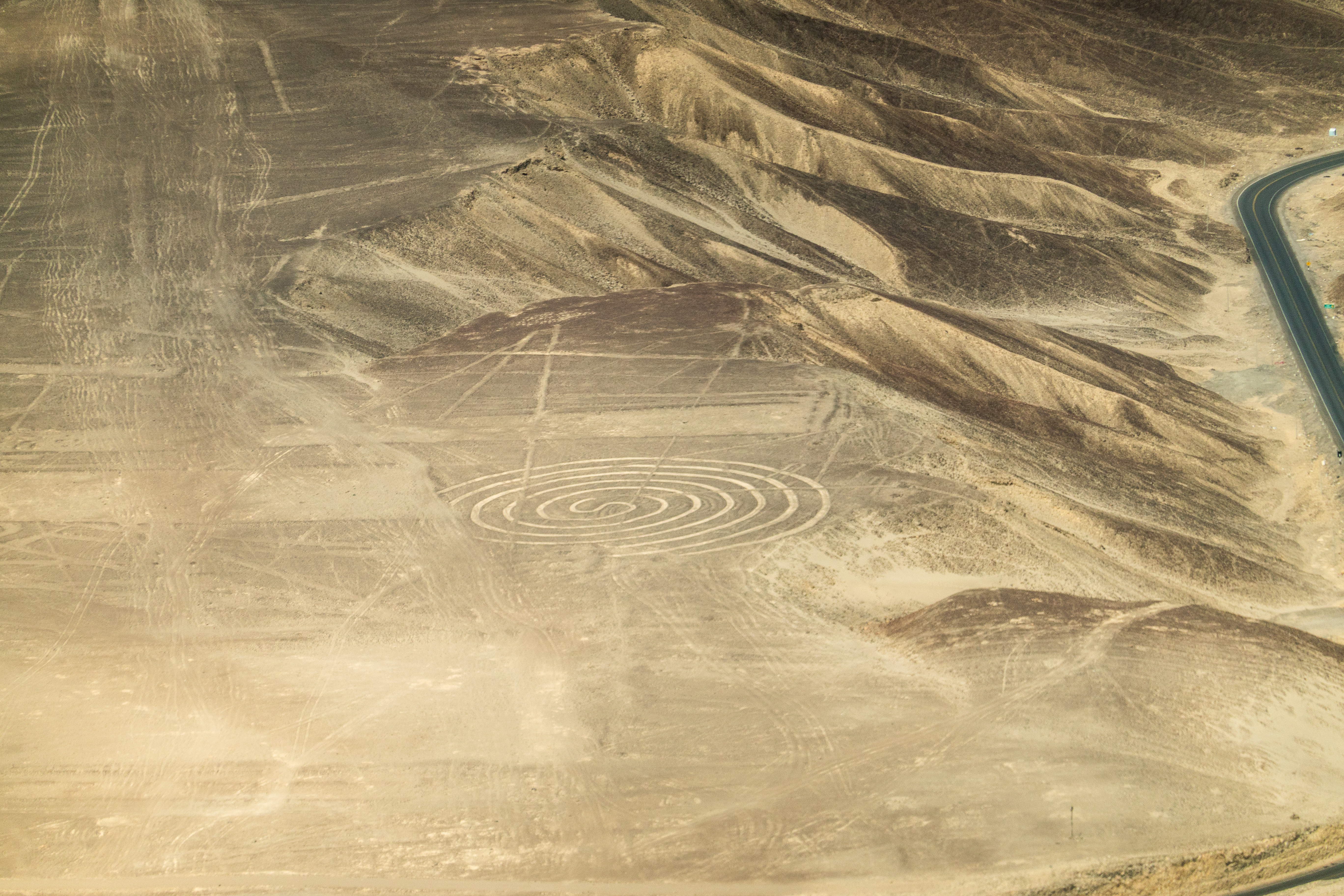
The Nazca Lines are a series of large geoglyphs etched into the soil of the Nazca Desert in southern Peru. Created between 400 BCE and 500 CE, these lines were made by removing the top layer of reddish-brown pebbles to reveal lighter-colored earth beneath. The geoglyphs include hundreds of simple lines and geometric shapes, along with more than 70 zoomorphic designs such as hummingbirds, spiders, and monkeys. These figures are best viewed from the air, suggesting a significant understanding of large-scale design by their creators. While the purpose of the Nazca Lines is still debated, prevailing theories suggest they had religious and astronomical significance. The arid climate and isolation of the plateau have aided in the preservation of these enigmatic lines, which continue to capture the interest of archaeologists and researchers worldwide.
Gallery
Explore photographs of ancient structures, artifacts, and archaeological excavations
Historical Timeline
Journey through time and discover key events in this site's history
Nazca phase geoglyphs
200 BCE - 500 CE
Paracas phase geoglyphs
400-200 BCE
Archaeological Features
Unique architectural and cultural elements found at this historical site
Artistic and Decorative Features
Frequently Asked Questions
Plan Your Visit
Tours, travel arrangements, and practical information


More Sites in Peru
Buena Vista, Peru
Ancient temple complex with observatory in Peru
Huaca Pucllana
Adobe pyramid with ceremonial and administrative areas
Cahuachi
Nasca ceremonial center with adobe mounds
Huaca del Sol
Largest pre-Columbian adobe pyramid in Peru
Paraccra (archaeological site)
Mountainous site with towers and houses.
Machu Pirqa
Ancient Chachapoyas wall in Peru.