Explore the Map
Tegher Monastery
40.3451° N, 44.2405° E
About
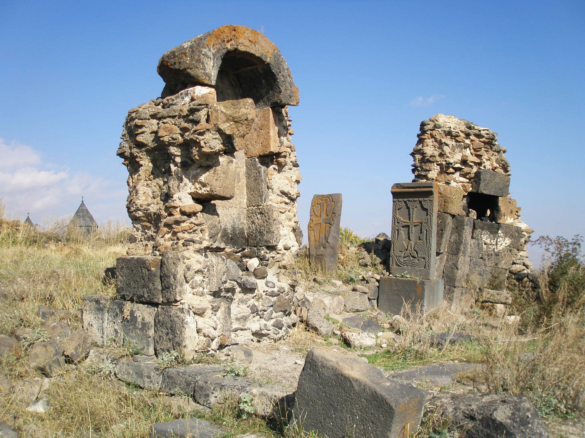
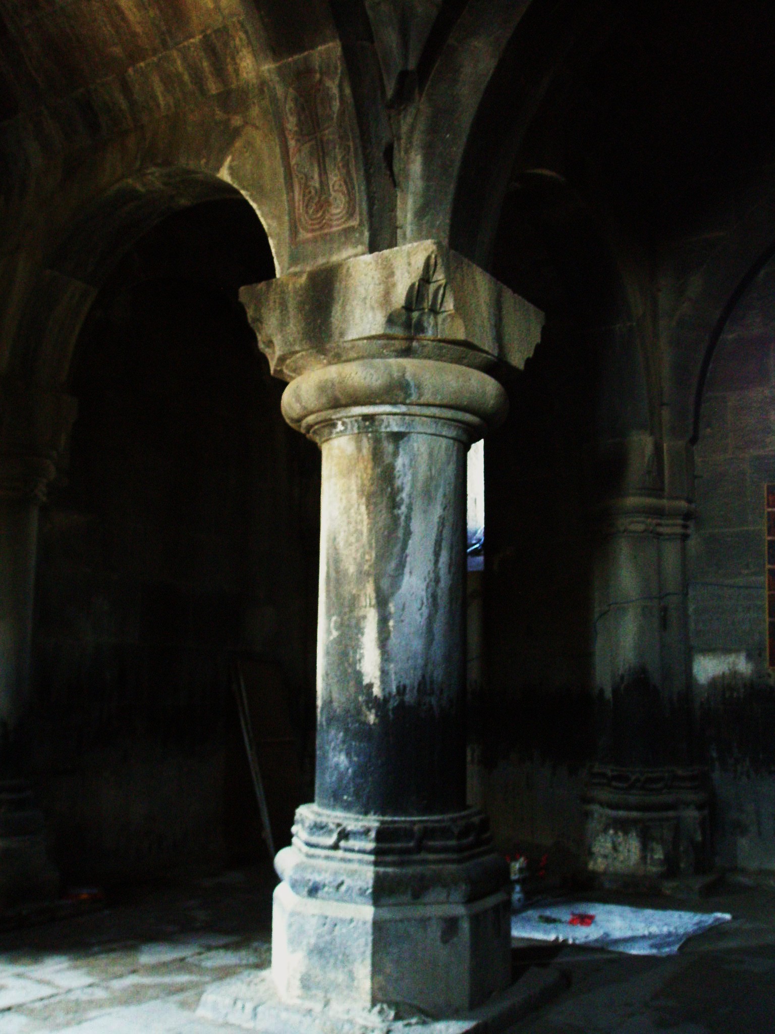
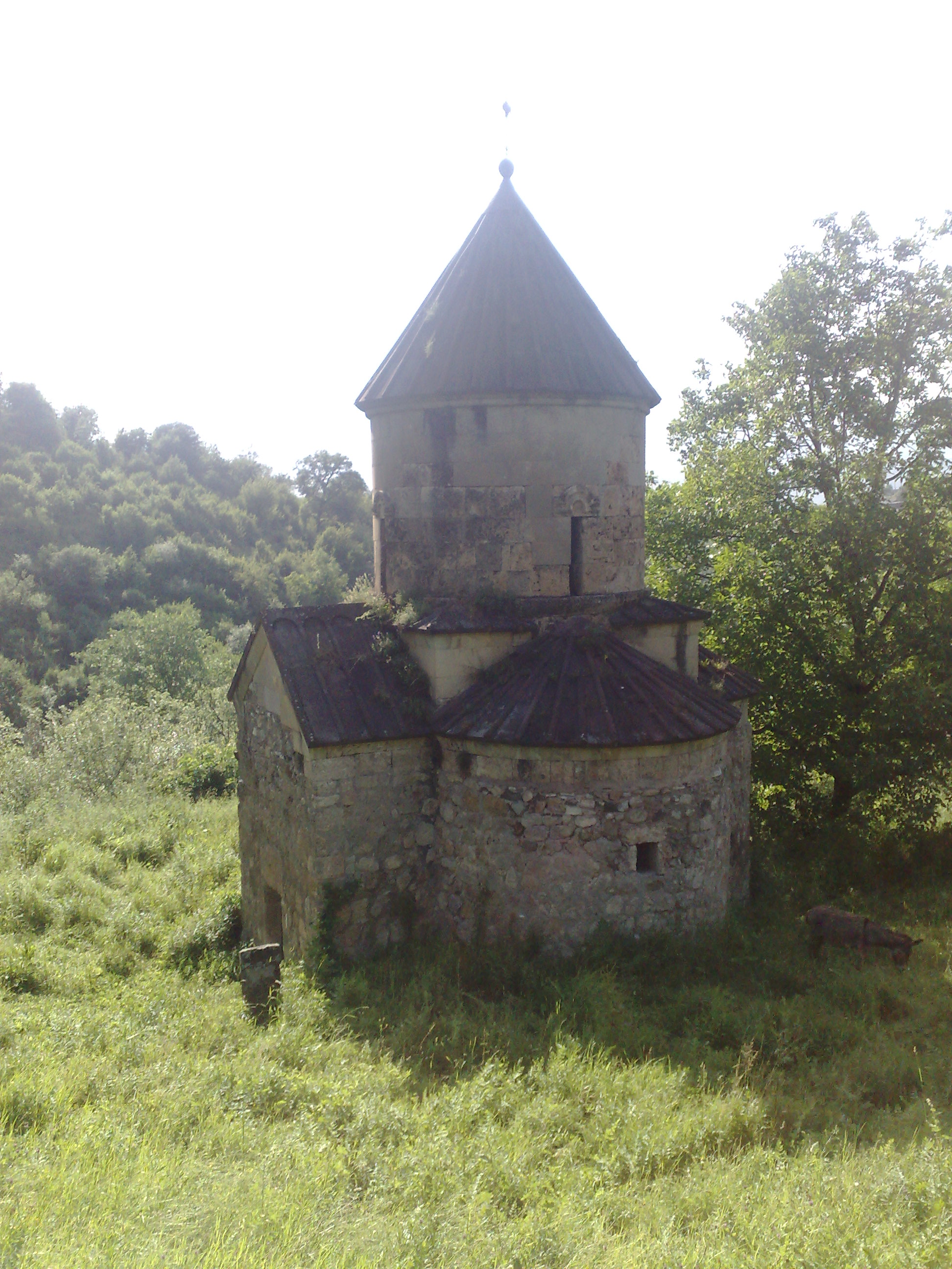
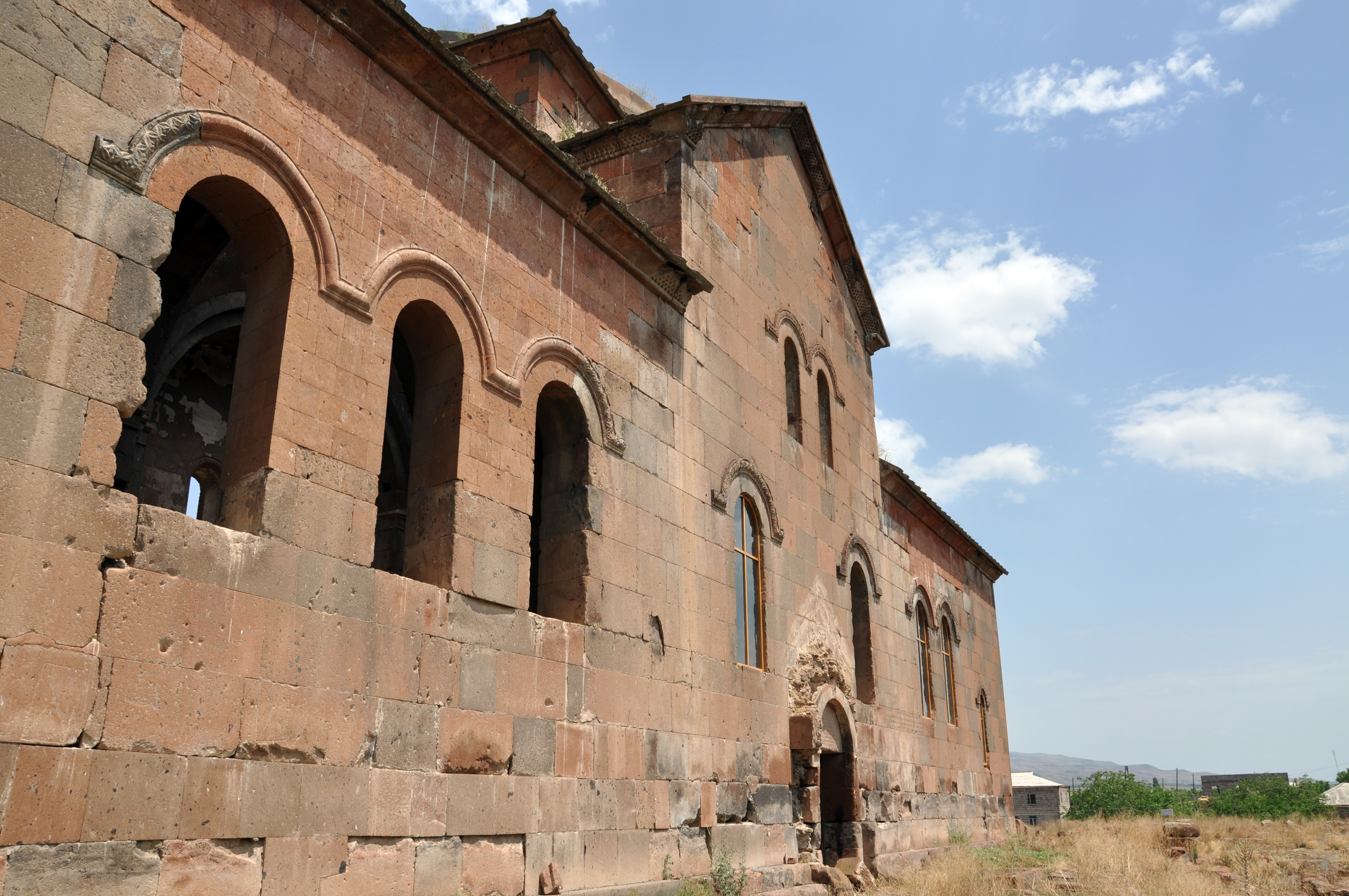
Tegher Monastery, located on the southeastern slopes of Mount Aragats in Armenia, is a significant 13th-century religious site. It was constructed for Princess Khatun, with the architectural expertise of Vardapet Aghbayrik, who also designed other notable monasteries during this period. The church of Surb Astvatsatsin, completed in 1213 CE, features a cruciform plan and dark gray basalt construction, exemplifying the architectural style of the time. The gavit, finalized in 1221 CE, showcases intricate design elements, including a central dome and oculus. The site also includes a medieval cemetery, mausoleums, and remains from earlier centuries, like the 5th-century Tukh Manuk chapel and ruins of the 9th-century village of Old Tegher. These elements highlight the cultural and historical significance of Tegher Monastery, providing insights into the religious and architectural developments in medieval Armenia.
Gallery
Explore photographs of ancient structures, artifacts, and archaeological excavations

Historical Timeline
Journey through time and discover key events in this site's history
5th-century Tukh Manuk chapel
5th century CE
Ruins of 9th-century Old Tegher
9th century CE
Construction of Surb Astvatsatsin Church
1213 CE
Completion of Gavit
1221 CE
Archaeological Features
Unique architectural and cultural elements found at this historical site
Burial and Funerary Structures
Religious and Ritual Structures
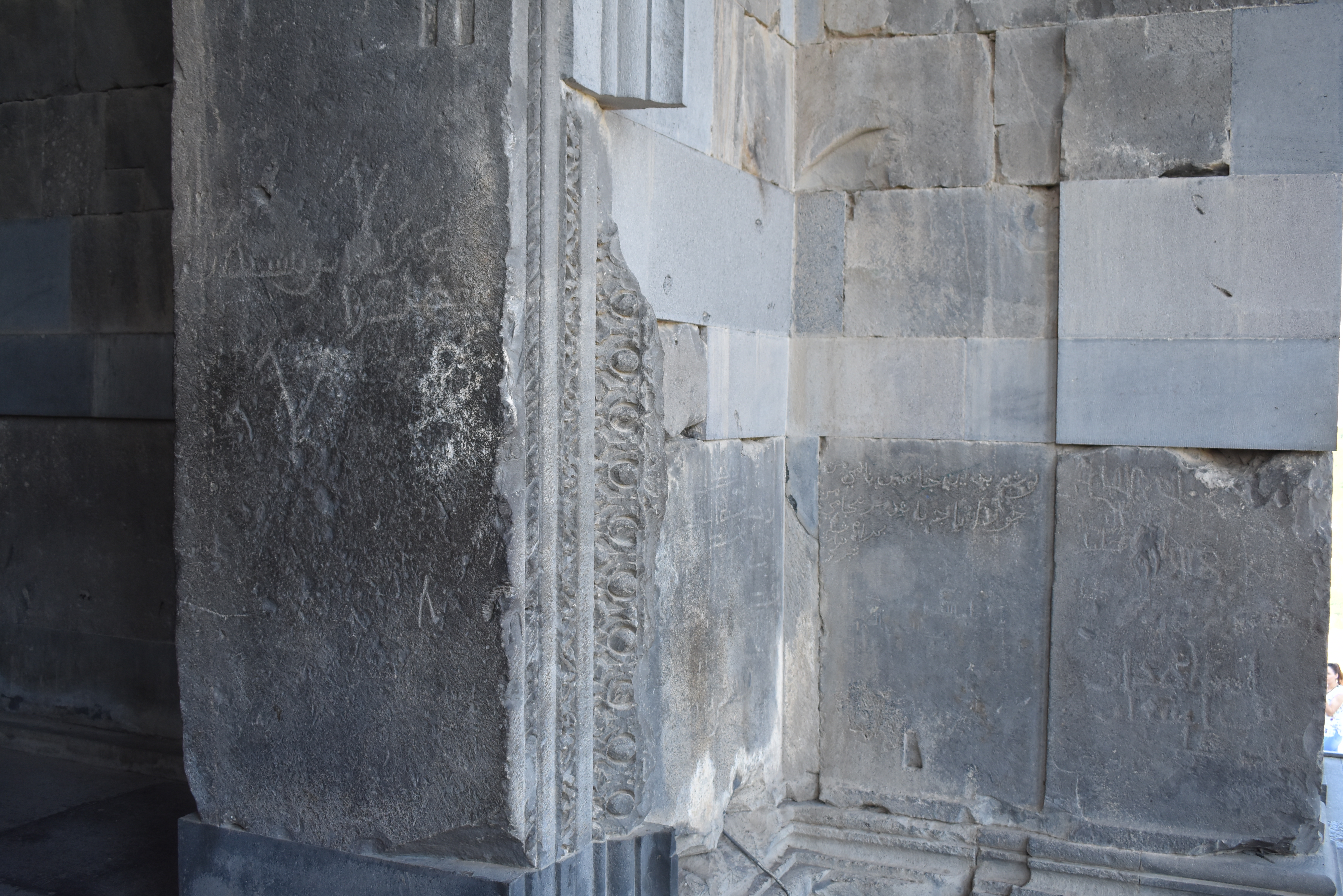
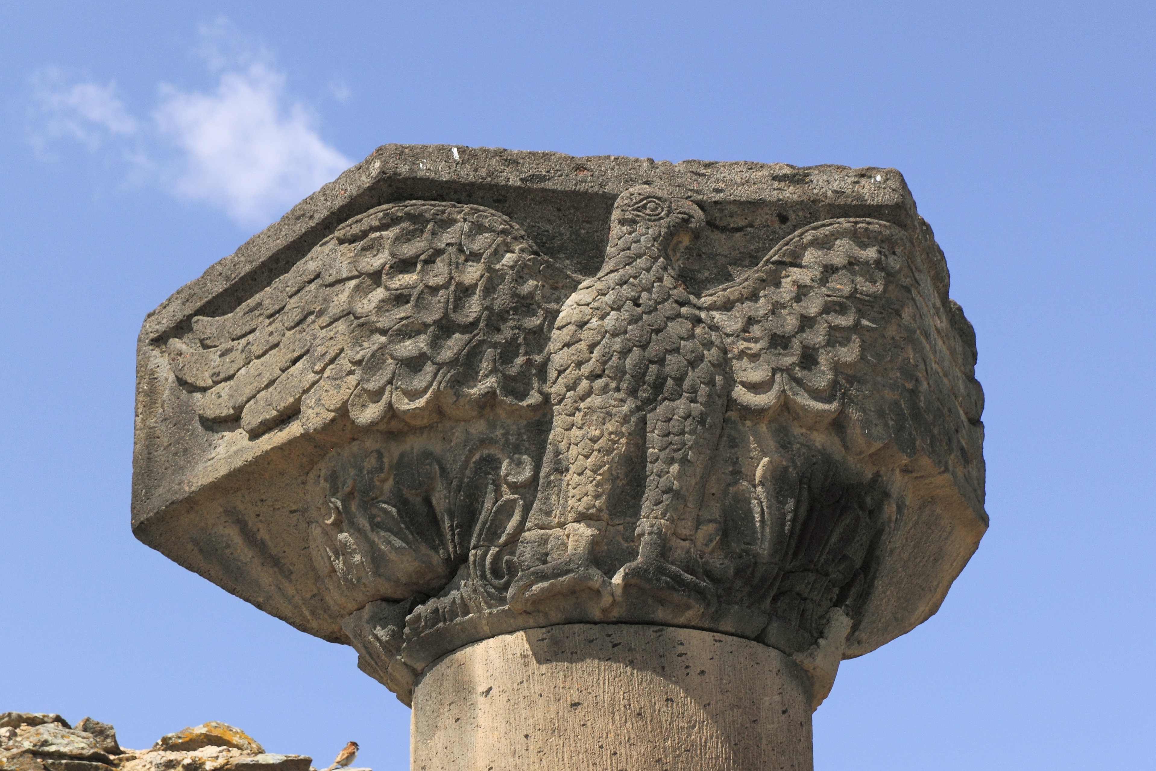
Artistic and Decorative Features
Domestic and Habitation Structures
Frequently Asked Questions
Plan Your Visit
Tours, travel arrangements, and practical information
Recommended Tours

More Sites in Armenia
Tsrviz Chapel
Medieval Armenian chapel with historical inscriptions.
Yererouk
Early medieval Armenian basilica on a plateau.
Garni Temple
Greco-Roman colonnaded temple in Armenia
Metsamor site
Ancient fortress with religious complex.
Zvartnots Cathedral
Circular medieval Armenian cathedral ruins
Aruchavank
Medieval Armenian domed hall basilica church