Explore the Map
Bhitargarh
26.4500° N, 88.6100° E
About
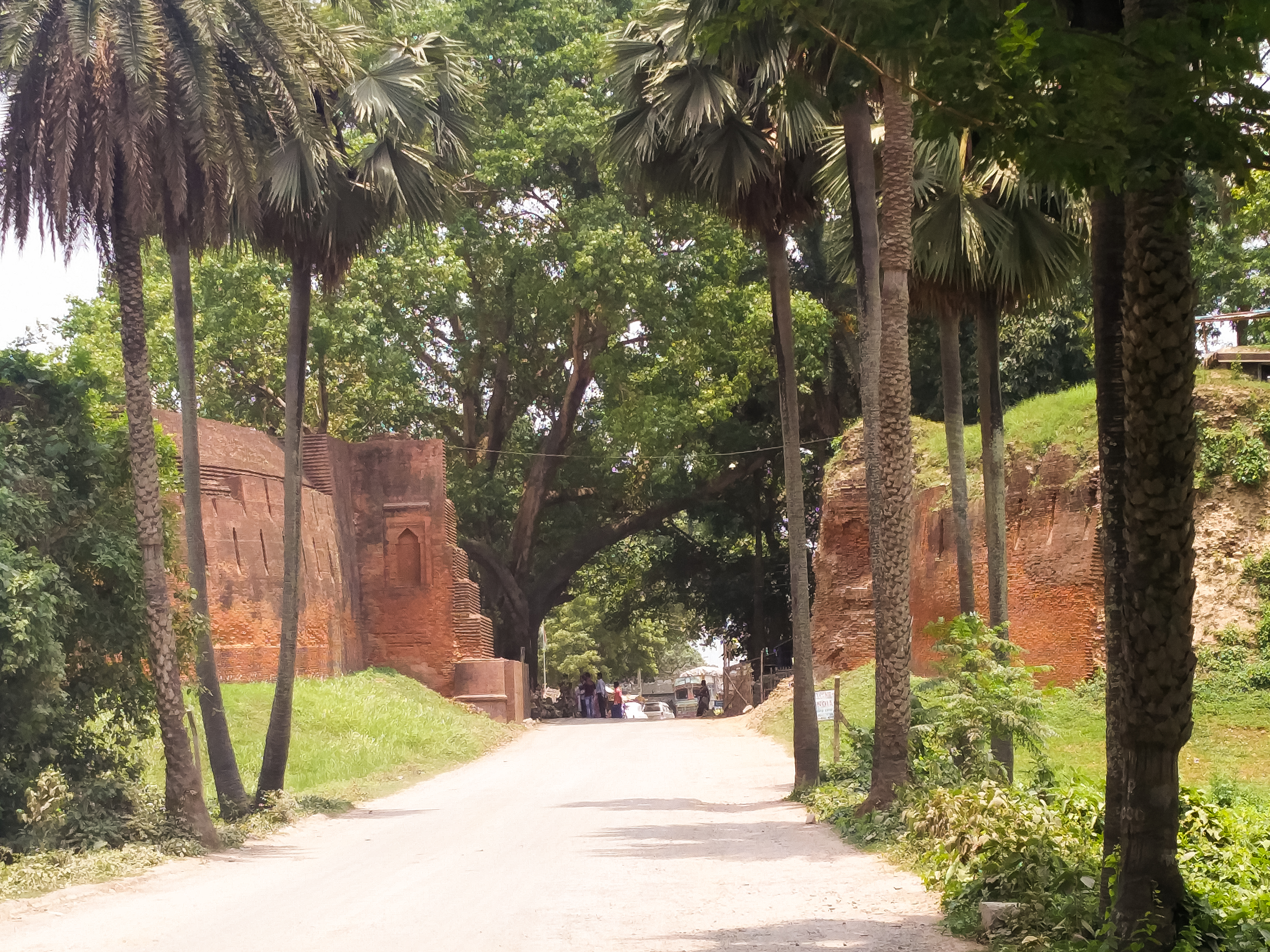
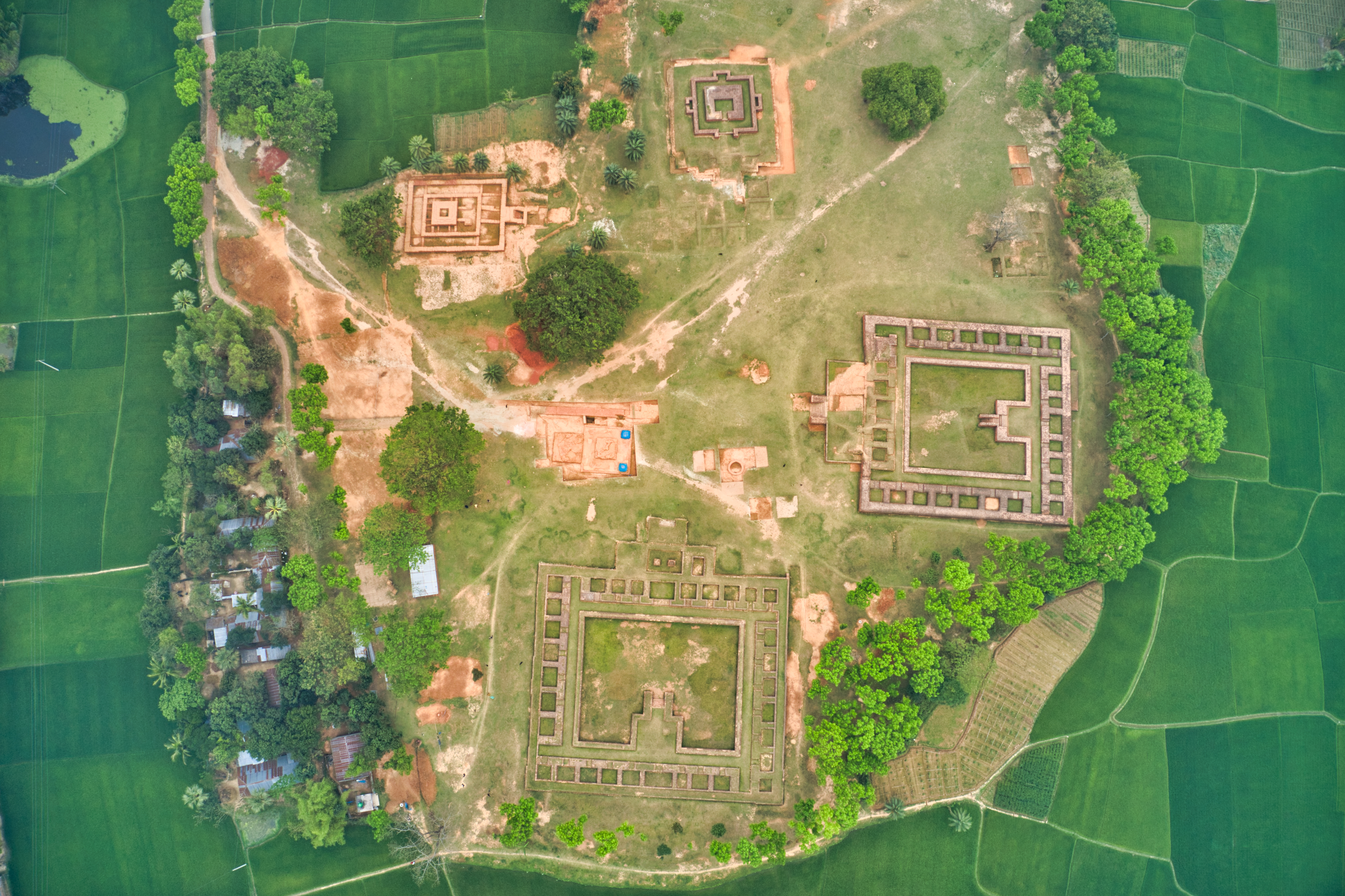
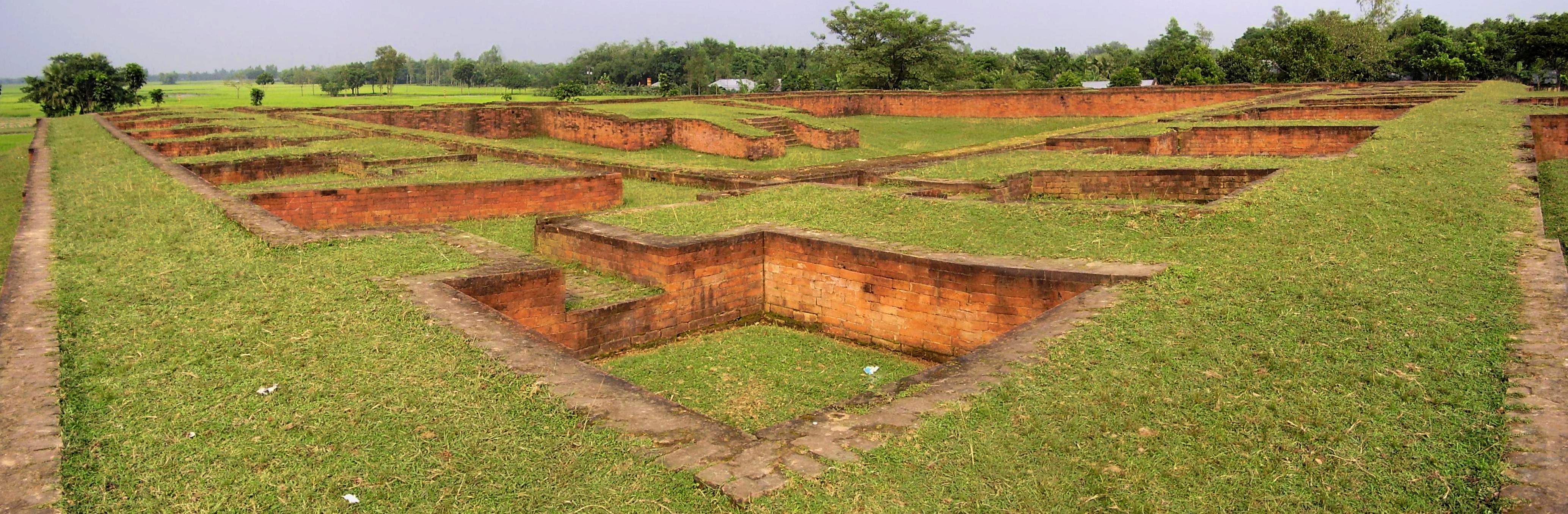
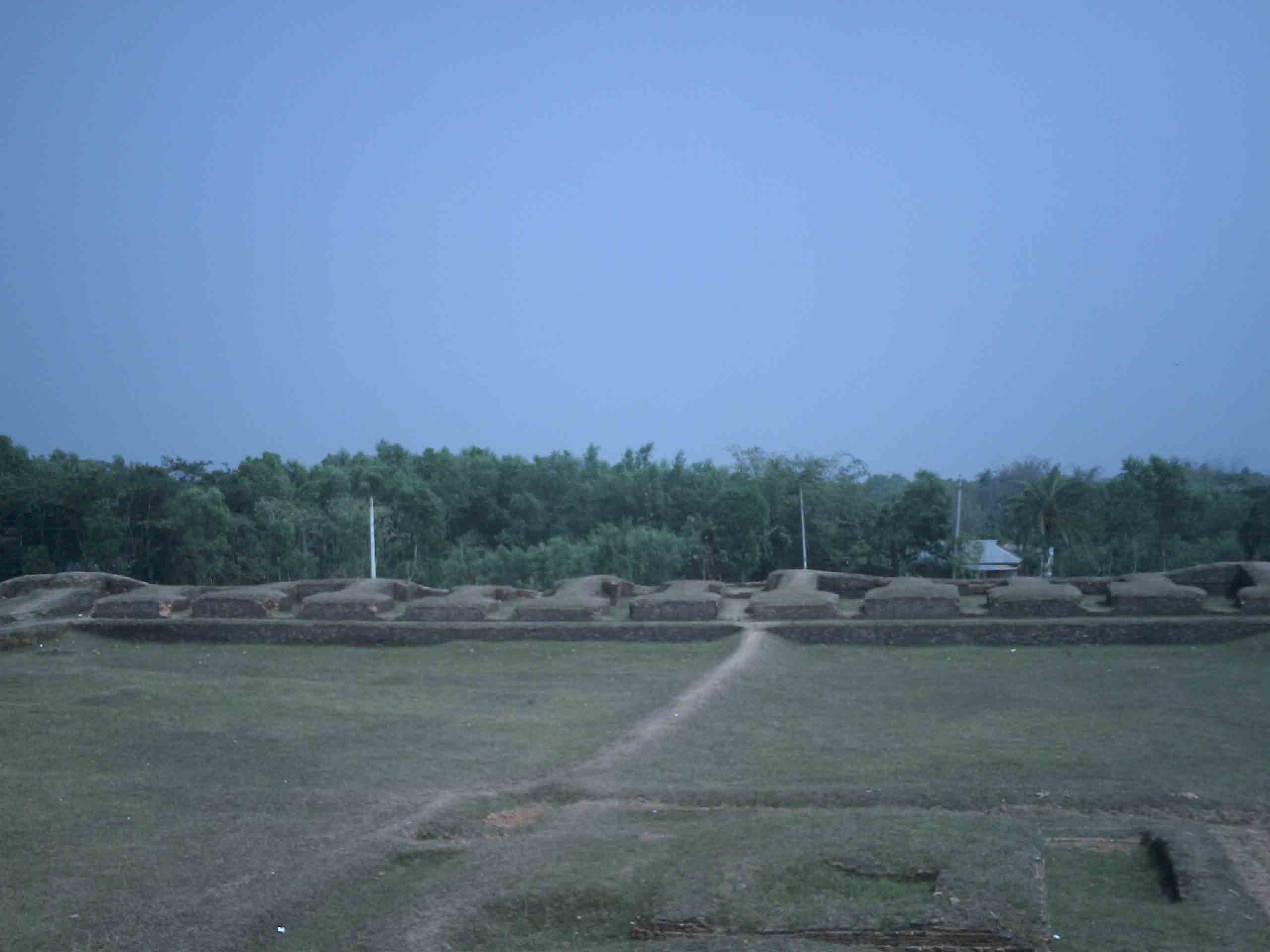
Bhitargarh (Bengali: ভিতরগড়) is an archaeological site that includes the remains of an ancient fort city built in and around the 5th century AD. It is located in Panchagarh District in Rangpur Division in the northern part of Bangladesh and is large enough that it can be seen from space. The archaeological significance of the site lies in its strategic position as an intersection of the trade routes between Tibet, Nepal, Bhutan and the middle and lower Ganges Valley. At its height the city stretched over 5 km by 3 km and involved rerouting the Talma River.
Historical Timeline
Journey through time and discover key events in this site's history
Artefact phases
7th–12th centuries AD
Foundation
5th century AD
Kamboja presence
10th century
End of sovereign city-state
13th century
Incorporation into Bengal Sultanate
1498
Mughal conquest
17th century
Modern excavations begin
2008
Resident population reported
2019
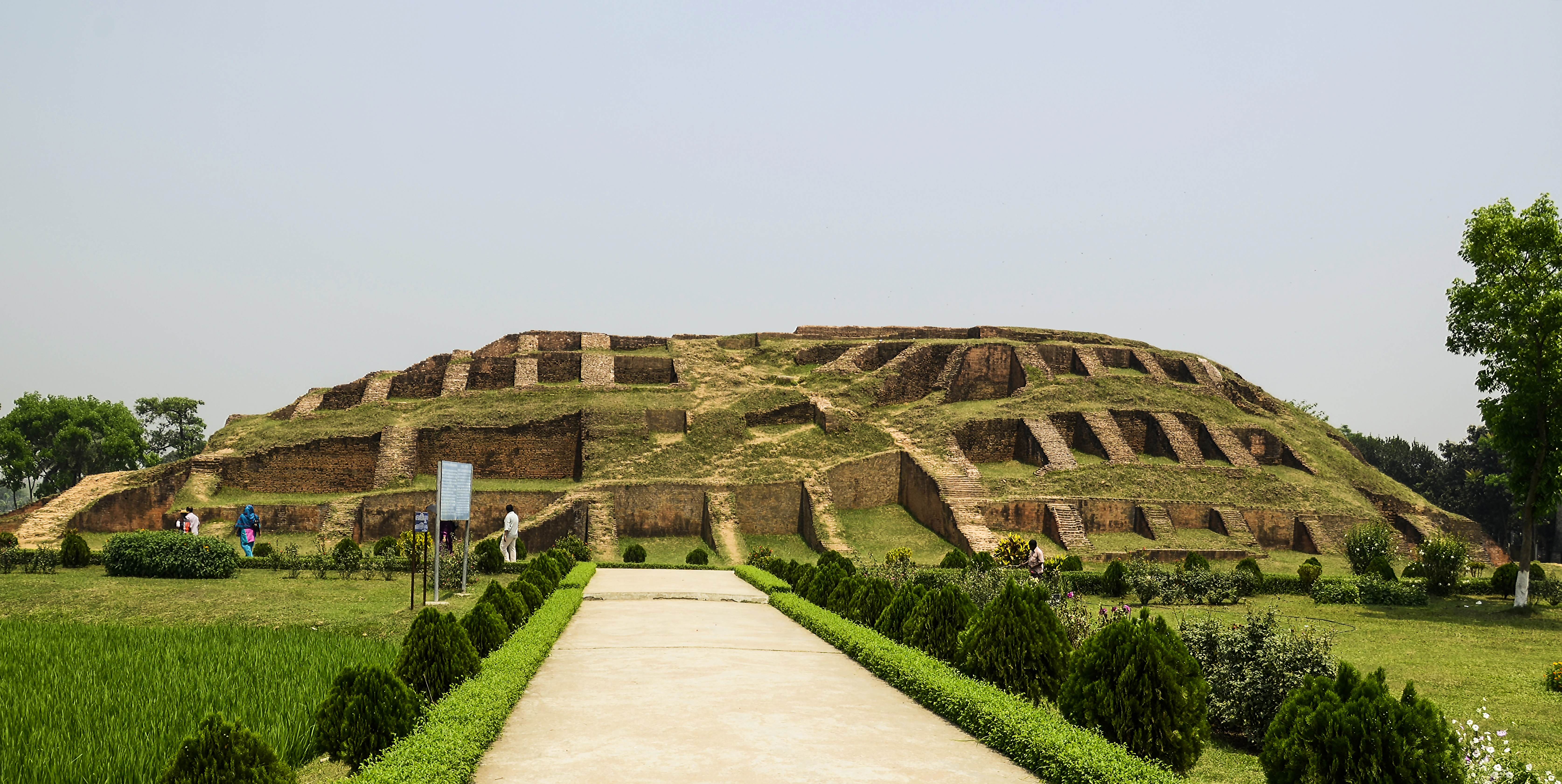
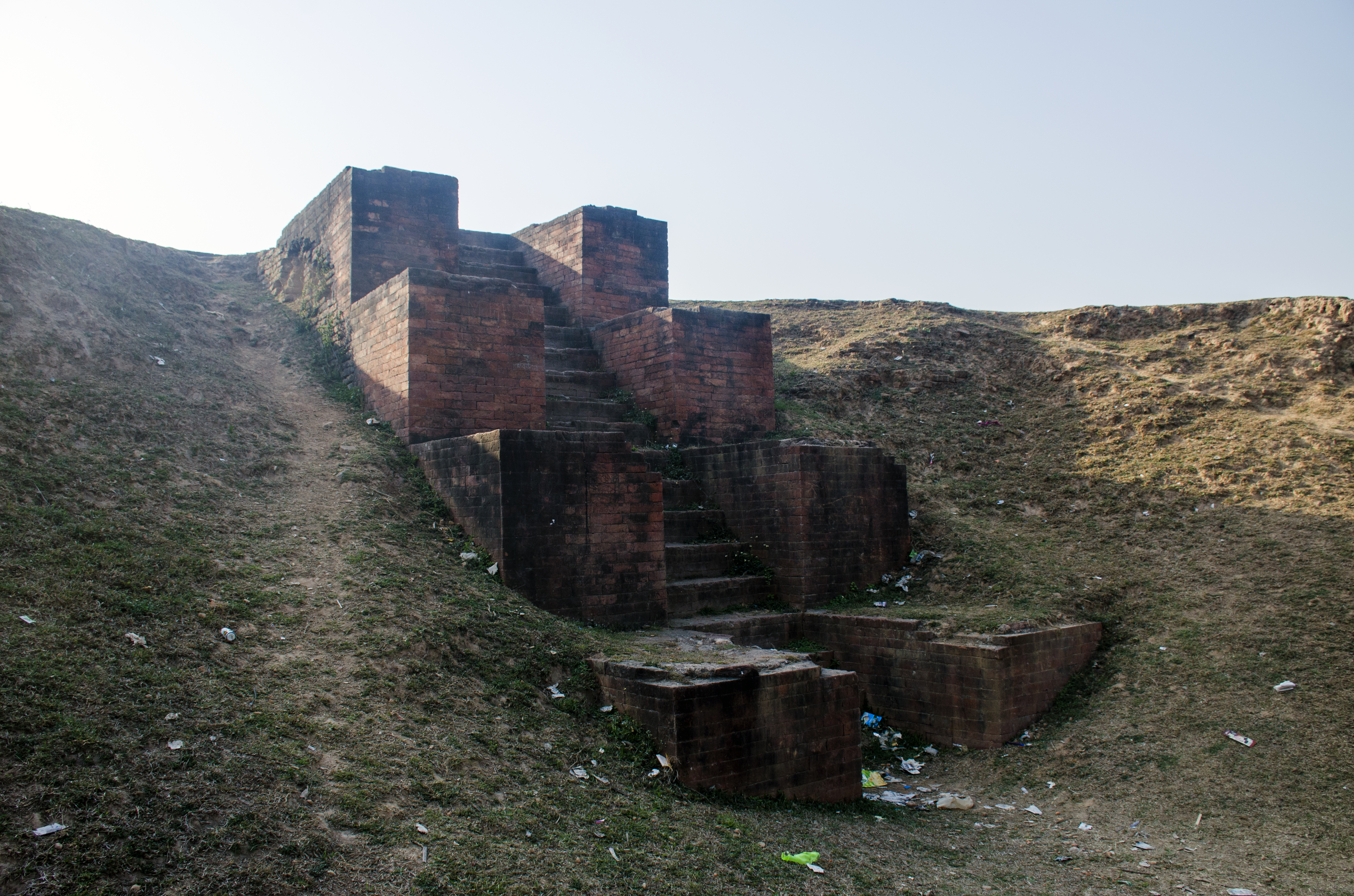
Archaeological Features
Unique architectural and cultural elements found at this historical site
Defensive Structures
Water Management Features
Religious and Ritual Structures
Artistic and Decorative Features
Agricultural and Land Use Features
Domestic and Habitation Structures
Environmental and Natural Features
Frequently Asked Questions
Plan Your Visit
Tours, travel arrangements, and practical information
More Sites in Bangladesh
Kotwali Gate
Medieval gate with collapsed central arch
Gokul Medh
Excavated Buddhist stupa and Shiva shrine
Vasu Vihara
Ancient Buddhist monastery complex with artifacts
Halud Vihara
Large mound with Medieval Buddhist structures.
Pundranagar
Fortified ancient city in Bengal region.
Mainamati
Isolated hills with Buddhist settlements